
Weather intelligence for the future: Crafting a strategic enterprise approach to changing environmental conditions
Continue reading

Key takeaways
- The November 2025 volcanic eruption of Hayli Gubbi sent ash 50,000 feet into a subtropical jet stream with winds exceeding 100 knots.
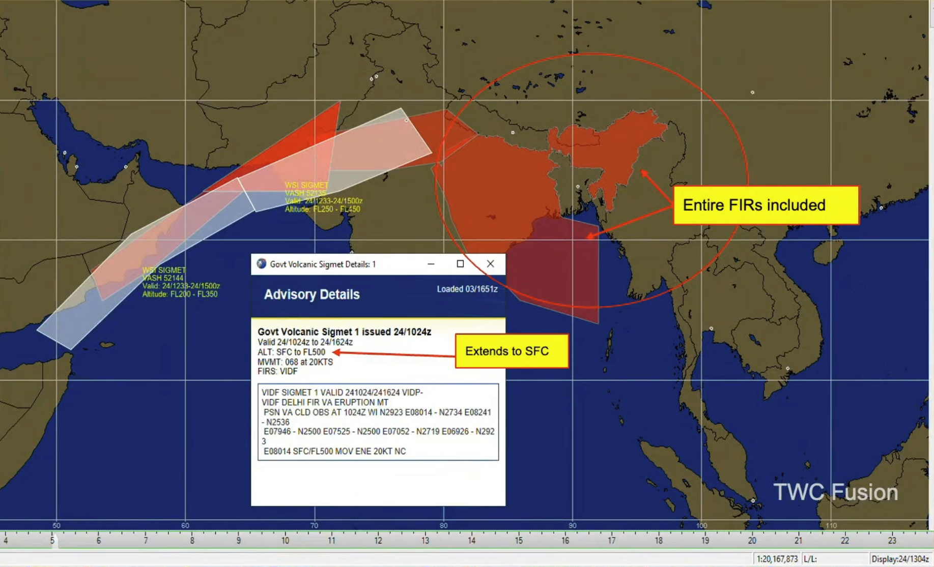
- Government SIGMETs often close entire Flight Information Regions (FIRs), but precision polygons kept safe corridors open for continued operations.
- Differentiating between hazardous ash and harmless sulfur dioxide prevented unnecessary and costly flight cancellations.
- High-frequency updates enabled surgical airspace management — avoiding disruptions without compromising safety.
- Precision volcanic intelligence within Enroute Hazards turns “just in case” diversions into confident, data-driven decisions that save fuel while keeping passengers and crew safe.
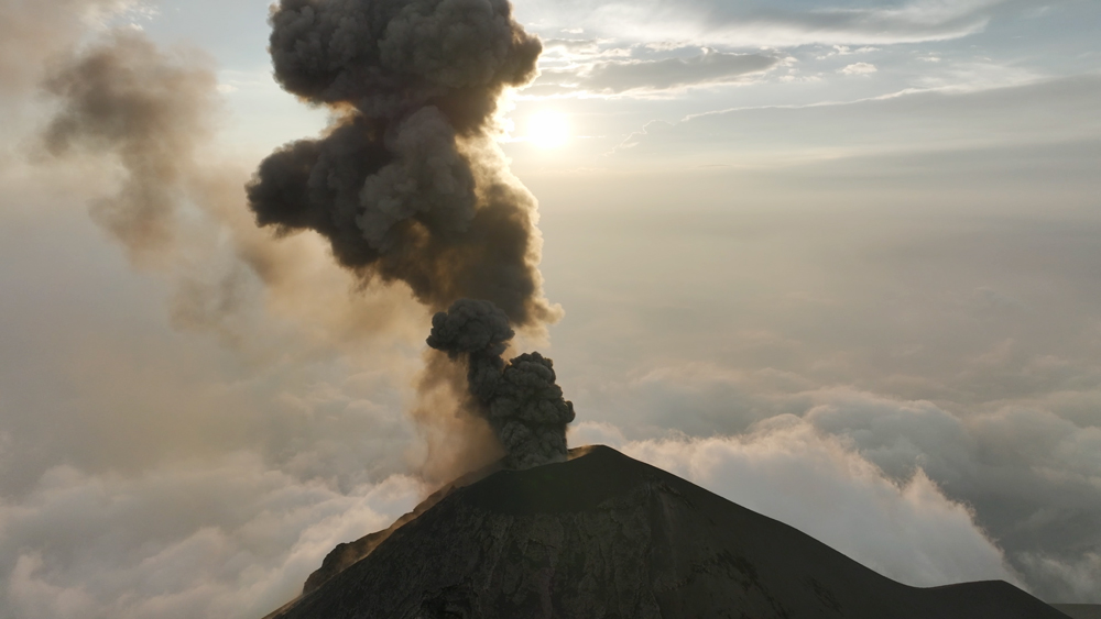
The November 2025 eruption of Hayli Gubbi in Ethiopia served as a wake-up call for the aviation industry. An ancient volcano with no recorded history of activity suddenly sent an ash plume 50,000 feet into the atmosphere, directly into one of the world’s most active subtropical jet streams.
For flight operations, the challenge wasn’t just the ash — it was the data. While government-issued SIGMETs (Significant Meteorological Information) shuttered massive swaths of airspace, The Weather Company provided a more surgical approach.
The Hayli Gubbi event: From quiet to 50,000 feet
On November 23, 2025, at approximately 08:22Z, Hayli Gubbi erupted. Because the volcano had no confirmed historical eruptions, it wasn’t on every operator’s immediate radar.
The timing was particularly difficult. A strong subtropical jet core was positioned directly over Ethiopia, with winds exceeding 100 knots. This acted as a conveyor belt, rapidly transporting high-level ash toward the Arabian Sea and India. By 19:45Z, three distinct ash layers were identified, with the highest reaching FL500 (50,000 feet) along the Yemen border.
The problem with “blanket” SIGMETs
When a major event like Hayli Gubbi occurs, the default response for many government agencies is to issue broad SIGMETs. During this event, we saw government advisories cover entire FIRs over India and Bangladesh, extending from the flight ceiling down to the surface.
For a Director of Flight Operations, these blanket closures are an operational nightmare. They lead to:
- Massive fuel burn due to long-range diversions.
- Widespread schedule disruptions across hubs like New Delhi.
- Increased pressure on flight ops teams to find viable routes in congested, restricted airspace.
A more surgical approach to Enroute Hazards
TWC SIGMETs clearly begin to offer more precision as compared to Government SIGMETs being issued over India and Bangladesh.
The Weather Company’s approach during the Hayli Gubbi eruption focused on high-frequency updates and particulate differentiation.
As the plume moved toward Central China, TWC meteorologists noticed a shift. While some agencies continued to flag the entire remnant plume as volcanic ash, TWC’s analysis suggested the trailing edge was primarily sulfur dioxide (SO2) — a gas that, while notable, does not pose the same structural threat to jet engines as abrasive volcanic ash.
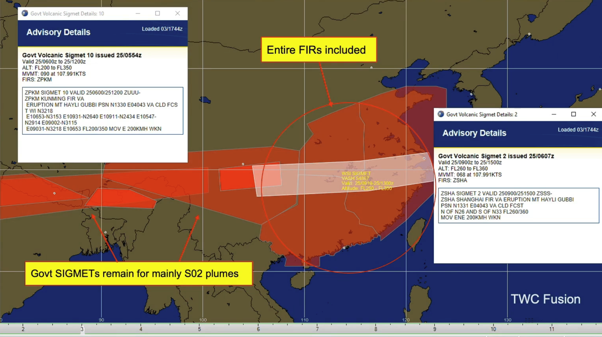
Over China, TWC SIGMETs focus on where the narrowing and thinning remnant ash resides.
The result: The Weather Company was able to drop SIGMETs over northern India and eventually east of Shanghai hours before official agencies, as our team confirmed the ash had dissipated into harmless gas.
Comparing government vs. The Weather Company SIGMET precision
A time lapse view of the Hali Gubbi event comparing government and TWC SIGMETs.
| Feature | Government SIGMETs | The Weather Company Volcanic Ash SIGMETs |
| Area coverage | Often entire FIRs (broad) | Precise polygons (targeted) |
| Update frequency | Standardized intervals | Constant monitoring & rapid updates |
| Vertical precision | Often surface to FL500 | Targeted at specific ash-layer altitudes |
| Data granularity | General ash presence | Differentiation between ash and SO2 |
Why precision is the ultimate safety tool
For pilots who may be looking at a weather brief that is already three or four hours old by the time they reach the cockpit, precision is synonymous with confidence. Knowing exactly where the “narrowing and thinning” remnant ash resides — rather than seeing a giant red block on the EFB — allows for better in-flight decision-making and fewer “just in case” diversions that eat into fuel reserves.
By integrating volcanic ash insights within our Enroute Hazards suite, we provide the clarity needed to keep the fleet moving without compromising passenger safety.
How confident is your volcanic ash response?
Don’t let outdated or overly broad advisories ground your fleet or put passengers at risk. See how our high-precision SIGMETs within Pilotbrief and Maverick Dispatch can streamline your operations during the next major eruption.
Let's talk
To learn more about our advanced aviation weather solutions, contact our aviation experts today.
Contact us