
Weather intelligence for the future: Crafting a strategic enterprise approach to changing environmental conditions
Continue reading

Key takeaways
- Severe weather coverage is the ultimate trust-builder and a core differentiator for modern broadcasters.
- A unified tech-stack – from real-time weather radar to automated severe weather alerts – is required to stay ahead of volatile storms.
- Advanced weather forecasting models like GRAFTM provide the neighborhood precision viewers demand during a crisis.
- The Max ecosystem streamlines workflows across platforms, allowing meteorologists to focus on storytelling rather than manual tasks.
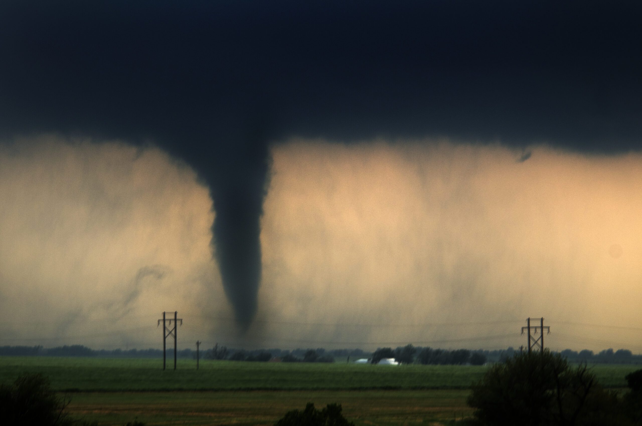
When a storm hits, you don’t get a second chance to get it right. In broadcast media, severe weather coverage isn’t just a news story – it’s the moment your audience needs you most. But as storms grow more frequent and volatile, the need for fast, clear, and trusted reporting has never been greater.
At The Weather Company, we believe that delivering timely, actionable updates is more than a competitive advantage. It’s a public safety responsibility. By leveraging our real-time weather radar, advanced weather forecasting models, and scalable severe weather alerts, broadcasters can finally move faster than the storm.
The high-stakes reality of severe weather broadcasting
When warnings are late or unclear, consequences follow. Lives are at risk. Trust erodes. In many communities, the local news station is the most trusted voice during dangerous weather. This trust is fragile, and once it’s broken, it’s incredibly difficult to win back.
Severe weather coverage is often the most-watched content a newsroom delivers. For instance, local TV audiences doubled in Orlando during Hurricane Ian, while streaming app reach surged by nearly 400%.1
Your severe weather coverage toolkit
To be the voice of authority, newsrooms need a cohesive ecosystem that translates complex atmospheric physics into clear, visual stories. The Max platform helps time-strapped meteorologists streamline response from the first cloud formation to the final “all clear.”
The Weather Company’s storm tracking capabilities go beyond industry standards, offering powerful, exclusive features not found in competitor platforms:
- Up to 12 individual streaming radar sites displayed simultaneously for full regional awareness
- One-click switching between radar moments, making it easy to shift focus as conditions evolve
- 3D storm structure visualization for sharper insights and clearer communication
- Early detection of storm rotation and automatic storm tracking, including debris markers
- GOES mesoscale sectors with real-time updates every 60 seconds
- Integrated on-air alerting and hazard-specific branding, automatically surfaced across all platforms
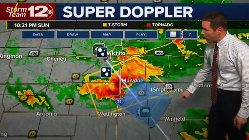
Max Storm: Powering precise visual communication
At the foundation of severe weather coverage is Max Storm, built to give meteorologists greater visual clarity and control during critical moments. With customizable color tables for radar, satellite, and model data, Max Storm helps teams highlight key threats with precision and speed.
From rapidly intensifying thunderstorms to dangerous winter weather, Max Storm delivers:
- High-definition visualizations that show 3D storm structure
- Real-time shear tracking and satellite analysis
- Automatic detection of hail, lightning, rotation, and tornadic debris
- Dozens of color table options to improve audience understanding
These capabilities help you look your best when storms are at their worst.
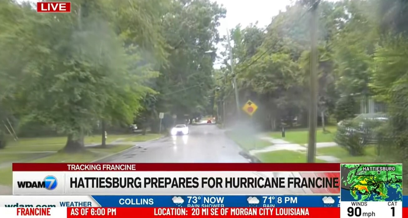
Max Alert Live: Scaling alerts across every screen
Once the forecast is ready, Max Alert Live delivers critical updates to audiences across channels – TV, mobile, OTT, apps, and digital platforms. By automating the distribution of severe weather alerts, Max Alert Live eliminates manual bottlenecks and keeps coverage consistent.
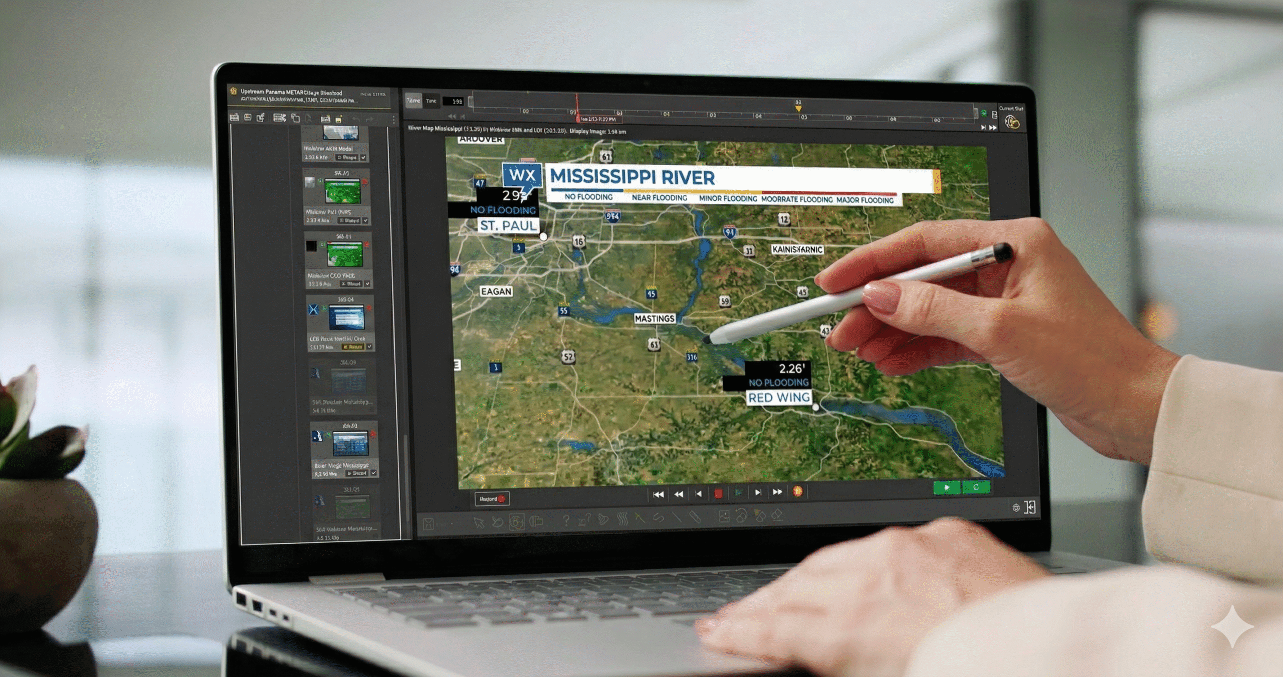
Example of on-screen alert with Max Alert Live
Teams can publish once and distribute alerts across all endpoints simultaneously, maintaining clarity and speed even as conditions shift.

See how WKRC-TV keeps viewers connected and safe in critical moments
Read case studyMax Velocity: Processing real-time weather radar
When seconds count, you can’t afford latency. Max Velocity acts as the high-speed engine for your real-time weather radar data. It allows meteorologists to ingest, process, and visualize storm cells with unprecedented speed. With this technology, your station can identify rotation or hail cores faster than legacy systems, providing the “why” and “where” with enough clarity for viewers to take immediate action.
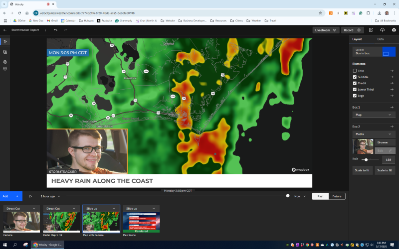
An example of how Max Velocity can be used to stream live to Facebook or YouTube to record quick updates for the station’s digital platforms
Max Studio: Dynamic interactivity and analysis
During a live break, the ability to “interrogate” the storm is what keeps viewers leaning in. Max Studio brings interactivity to your severe weather coverage, allowing talent to manipulate data on touchscreens or through gesture-based controls. It allows meteorologists to break down complex weather forecasting models into digestible, neighborhood-level insights that show exactly who is in the path of danger.
An example of touch-screen interaction using Max Studio during severe weather storytelling
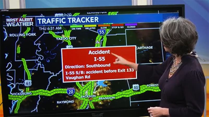
Max Traffic: Visualizing impact on the ground
Integrating traffic into your severe weather coverage provides a unique utility that keeps audiences tuned in long after the initial severe weather alerts have expired. Max Traffic lets you own the “commute” narrative by combining real-time weather and traffic data into a single, compelling story.
When morning storms threaten visibility, you can show not only what’s happening but what it means for the drive. With live traffic camera integration and a new partnership with Total Traffic & Weather Network (TTWN), Max Traffic helps broadcasters bring deeper, more actionable insights to every screen.
- Reliable, audience-focused data: TTWN gathers real-time traffic conditions from trained reporters across the U.S., helping stations deliver high-impact incident updates that matter most to local viewers.
- Deeper incident insight: Sixteen regional operations centers provide 24/7 coverage of traffic incidents from inception to resolution, delivering greater accuracy and immediacy.
- Clearer visual storytelling: Max Traffic’s map design emphasizes key highways and commuting corridors, stripping out side-street clutter to keep the viewer focused on what’s relevant.
The Max advantage
In the race to be first and most accurate during a storm, the right tools make the difference. While others are catching up, Max is already there. Here are industry-exclusive features designed to help you own the storm and protect your viewers:
- Up to 12 individual streaming radar sites displayed simultaneously
- Interactive access to alternative visual storm data in a single display
- Support for Climavision radars to fill gaps where NWS coverage may be poor
- Time-lapse video automatically displayed in time with radar data
- GOES mesoscale sectors for real-time analysis updated every minute
- Manual tracking of a point storm by speed or time
- Wide variety of severe-weather-analysis data per identified storm cell (off-air query)
- On-air alerting
- Hazard type auto-query displayed based on camera range
- Informative branding automatically changed based on event type
- Automatic surfacing and posting of content to TV, CTV, web, social and/or mobile based on the hazard
- Automatic surfacing and posting of content to TV, CTV, web, social and/or mobile based on tropical updates
- Ice/rain/snow precipitation accumulation analysis tools
- Proprietary global high-resolution model with precipitation output at 5-minute timesteps and new model runs up to every hour
- Wide array of natively included model data in base offering (HRRR/NAM/GFS/ECMWF/GEM/NDFD/GRAF)
- Automatic simultaneous display of all tropical storms from a particular basin
The science of speed: Next-gen weather forecasting models
The science behind weather forecasting models has reached a tipping point. To stay ahead of a rapidly changing cell, “hourly” updates are no longer enough.
Our proprietary Global High-Resolution Atmospheric Forecasting (GRAF) model is the engine behind the next generation of coverage. Built on a GPU-accelerated supercomputer in partnership with NVIDIA, GRAF provides a level of precision that legacy weather forecasting models simply can’t match:
- Hyper-local precision: 3.5km resolution allows you to see weather impacts at the neighborhood level.
- Unmatched frequency: Updates hourly with 5-minute forecast intervals.
- The competitive edge: GRAF delivers insights 6x faster and at 3x the resolution of leading global models.
As the world’s most accurate forecaster,2 we don’t just help you deliver severe weather coverage. We help you deliver it better, faster, and at scale.
Trust is earned the hour before the storm
In moments of chaos, the station that stays calm and clear earns lifetime loyalty. Reliable severe weather alerts, combined with critical human insight, reinforce your reputation as the source people turn to first. That’s just one reason over 80% of North American broadcasters trust the Max platform.3
The next generation of severe weather alerts is more personalized, proactive, and precise. The Weather Company brings decades of experience, proven technology, and a commitment to accuracy to every solution we offer. From weather forecasting models to real-time weather radar, your newsroom can stop reacting to the weather and start leading the conversation.
Don’t let a legacy workflow slow down your response. Book a demo of the Max platform today.
Let's talk
Want to strengthen your severe weather coverage across every screen? Discover how The Weather Company’s Max platform can help your team deliver faster, clearer, and more trusted alerts when every second counts.
Contact usFrequently asked questions
Our weather forecasting models utilize a multi-model approach, combining over 100 government and proprietary sources, including GRAF, enhanced by AI and guided by human expertise. This allows us to deliver hyperlocal, on-demand forecasts that are continually refreshed. According to ForecastWatch, The Weather Company is nearly four times more likely than other providers to be the most accurate across all global regions and metrics.4
Max Alert Live simplifies and accelerates the process of creating, localizing, and distributing severe weather alerts across TV, mobile, streaming, and digital platforms. Automating this workflow reduces lag time and helps broadcasters deliver consistent, clear, and timely alerts, reinforcing trust when speed matters most.
GRAF (Global High-Resolution Atmospheric Forecasting) is The Weather Company’s proprietary physics-based model. It delivers 5-minute forecast data at 3.5km resolution, updates hourly, and runs on a GPU-accelerated supercomputer in partnership with NVIDIA. Compared to leading models, GRAF operates 6x faster and at 3x the resolution, enabling more accurate and earlier predictions of high-impact weather events.
Yes. Max Traffic combines traffic and weather data into a unified visual format that shows how storms, road closures, or visibility issues will affect viewer commutes. It’s especially effective for morning broadcasts and can help stations build stronger viewer loyalty – and even increase ROI through traffic-related sponsorships.
Our weather solutions are designed to scale across all delivery platforms. Whether you’re reaching viewers via live TV, mobile apps, OTT, or social, we help make sure your severe weather coverage is consistent, accurate, and visually engaging on every screen.
Related resources


1 Nielsen, Understanding Local Media Reach During Extreme Weather Events, February 2024
2 4 ForecastWatch, Global and Regional Weather Forecast Accuracy Overview, 2021-2024, commissioned by The Weather Company
3 Internal data as of December 31, 2025