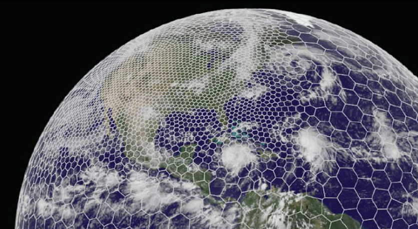
The latest GRAF® weather model improvements
Continue reading


Weather radar is always a hot topic among our clients. That’s why we compiled the most frequently asked questions to create a basic overview of radar technologies, options and benefits.
What is a weather radar?
Weather radar (also known as Doppler weather radar) is an instrument that sends pulses of electromagnetic energy into the atmosphere to find precipitation, determine its motion and intensity, and identify the precipitation type such as rain, snow or hail.
When the electromagnetic pulse strikes an object such as a raindrop or a snowflake, the wave reflects back to the radar with data that can be analyzed by meteorologists. Meteorologists can use this information to determine specific areas where dangerous weather conditions exist. As a result, radar can be an exceptional tool in a meteorologist’s arsenal for helping to protect life and property.
How does a weather radar work?
Weather radar utilizes either a solid-state or tube transmitter to send energy pulses (also known as radar beams) into the air to detect precipitation. This focused beam radiates outward from an antenna (also known as a radar dish). If the radar beam bounces off precipitation such as rain or hail, the beam will return to the weather disk, where the data is processed into various parameters. This enables a meteorologist to analyze and interpret the type of weather occurring dozens of miles away from the radar.
Weather forecasters determine the distance to an oncoming storm and the amount of precipitation by the strength and speed of the pulse returning to the weather radar site. Precipitation type, motion, turbulence and many more useful determinations can also be made, such as recognizing the debris that a tornado would throw into the air (known as a debris ball).
What is Doppler Radar and how does it work?
Doppler radar systems provide information about the movement of targets as well as their position. When pulses of radio waves are transmitted, the system keeps track of the phase of those pulses. When measuring the change in phase between a transmitted pulse and the received echo, the target’s movement toward or away from the radar can be calculated. This then provides a radial velocity.
Meteorologists have many tools at their disposal, including radar, to predict the weather forecast. Radar can decipher how far away precipitation is, its speed and how big droplets or snowflakes are. This data can then be used in computer forecasting models to predict future weather trends, while alerting meteorologists to upcoming precipitation, storms or severe weather.
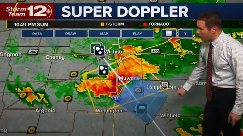
What do weather radar colors mean?
Weather radar sends the information received to a computer that outputs the vibrant green, yellow and red colors we see every day in forecasts. Typically, heavier rain is displayed by warmer colors.
Although green generally indicates light rain, yellow indicates moderate rain and red indicates heavy rain or hail, our Max broadcast product allows users to customize their own color table.
What are the types of weather radar bands?
Doppler radar can be broken up in terms of wavelength. This includes the following:
S-Band radars
Wavelength: 8 – 15 cm
Frequency: 2 – 4 GHz, although most weather S-Band radars operate within the 3.0 – 3.8 GHz frequency
Use cases: This radar’s longer wavelength allows the beam to penetrate through several bands of precipitation, expanding the range for analysis further than the C-Band radar. As with all radars, the further the beam is away from the radar site, the higher the beam is above the ground. Therefore, what is analyzed aloft is not always what one would experience at the ground level. However, the ability to see and analyze precipitation returns from greater distances does help the meteorologist generate weather alerts further in advance. This radar is the most expensive of the three radar bands.
C-Band radars
Wavelength: 4 – 8 cm
Frequency: 4 – 8 GHz, although most weather C-Band radars used for weather operate in the 5.3 – 5.6 GHz range
Use cases: C-Band radars are often intended for short-range weather observation but can be used in medium- to long-range precipitation analysis. The wavelength of the radar beam can penetrate through moderate to heavy bands of precipitation to identify what is beyond the closest precipitation band. However, the beam does attenuate (that is, loses its strength) much more than the longer wavelength S-Band and therefore does not recognize precipitation rates as accurately as the S-Band. These radars are generally smaller and less expensive than S-Band weather radars, but more expensive than the smaller X-Band radar.
X-Band radars
Wavelength: 2.5 – 4 cm
Frequency: 8 – 12 GHz
Use cases: X-Band radars have a smaller wavelength that makes them more sensitive to lighter particles. These radars are also more susceptible to attenuation as the smaller wavelength does not allow the radar beam to penetrate through heavy precipitation bands. This can block the radar from seeing past the initial band of precipitation to identify what could be approaching.
The X-Band radar generally uses a smaller antenna dish and therefore is much less expensive than C- and S-Band radars.
There are two ways in which most broadcasters would use an X-Band radar:
- Since it is small, this radar can be mounted on a trailer or truck, making it very mobile. The radar could be driven to the storm to gain a more accurate depiction of dangerous weather at the ground level rather than using a fixed radar in which the beam would get higher above ground as it got farther away from the radar tower.
- Another option is to purchase a network of X-Band radars and position them in fixed locations. This approach helps meteorologists see what’s behind a heavy precipitation band and more realistically depict what is occurring at the ground level.
What are some key developments in weather radar technology?
Weather technology is constantly evolving. Let’s take a closer look at the innovations in weather forecasting.
Pulse Radar
Basic Pulse Radar: This type of radar is the most common. The signal consists of a repetitive train of short-duration pulses. The pulse is both transmitted and received by one antenna in such a way that the “echo” signal is received before the next pulse is sent.
Moving Target Indication Radar: This is an older type of radar used to discriminate a target against clutter. “Clutter” generally refers to fixed objects that the radar beam would always pick up such as buildings, hills or mountains. This radar can identify moving precipitation through the use of the Doppler effect.
Continuous Pulse Radar
Unmodulated Continuous Wave Radar: This radar can return frequencies that are shifted away from the transmitted frequency based on the Doppler effect when objects are moving. Continuous Wave Radars are typically used with competitive sports. These radars cannot determine distance. This also requires two antennas – one to transmit the signal and one to receive the signal.
Frequency Modulated Continuous Wave Radar: This short-range measuring radar set also uses two antennas – one to transmit and one to receive the signal. However, this radar not only measures the motion of the precipitation but also the distance to the precipitation.
Dual Polarization
This type of weather radar allows for two beams to be sent out with vertical and horizontal orientations. This permits forecasters to determine both the size and shape of precipitation, which is useful when differentiating snow from rain.
As with all radars, dual-polarization technology is less relevant the farther the radar site is from the signals returning to it. The curvature of the earth results in the radar signals being higher off the ground when the weather disk is farther away. This is also known as “the gap.”
The Doppler Effect
The Doppler radar uses what is known as the Doppler effect. In essence, the frequency of the radar signal increases when precipitation is moving towards the radar and decreases when precipitation is moving away from the radar. This can be vital in predicting tornadoes or gusts of wind.
Weather Radar Forecast Models
Weather radar data can be incorporated with other sources such as IoT sensors and past trends to create forecast models. By leveraging AI, meteorologists can better predict weather patterns for a more accurate forecast.
What are the components of a weather radar?
Weather radars have five basic components. To gain the right insights from radar data, it’s important to understand how these components operate and work together. The components include:
- Transmitter: The transmitter generates the energy pulse.
- Antenna/ radar dish: Modern radar tools are composed of a large radar dish and a protective layer to shield it from deterioration. The dish can rotate in order to gather data and information from different areas. Meanwhile, an antenna sends pulses into the atmosphere and receives the reflected pulses. As the energy signal interacts with objects, energy waves scatter with some bouncing back to the weather radar.
- Radar processor: A radar processor is used to compile and analyze the radar data that returns to the dish/antenna. It uses information such as the distance of the signal to determine the weather forecast.
- Receiver: The receiver recognizes and magnifies the signal.
- Display system: One display system should be directly associated with the radar and another should be for broadcasters to display to their viewers
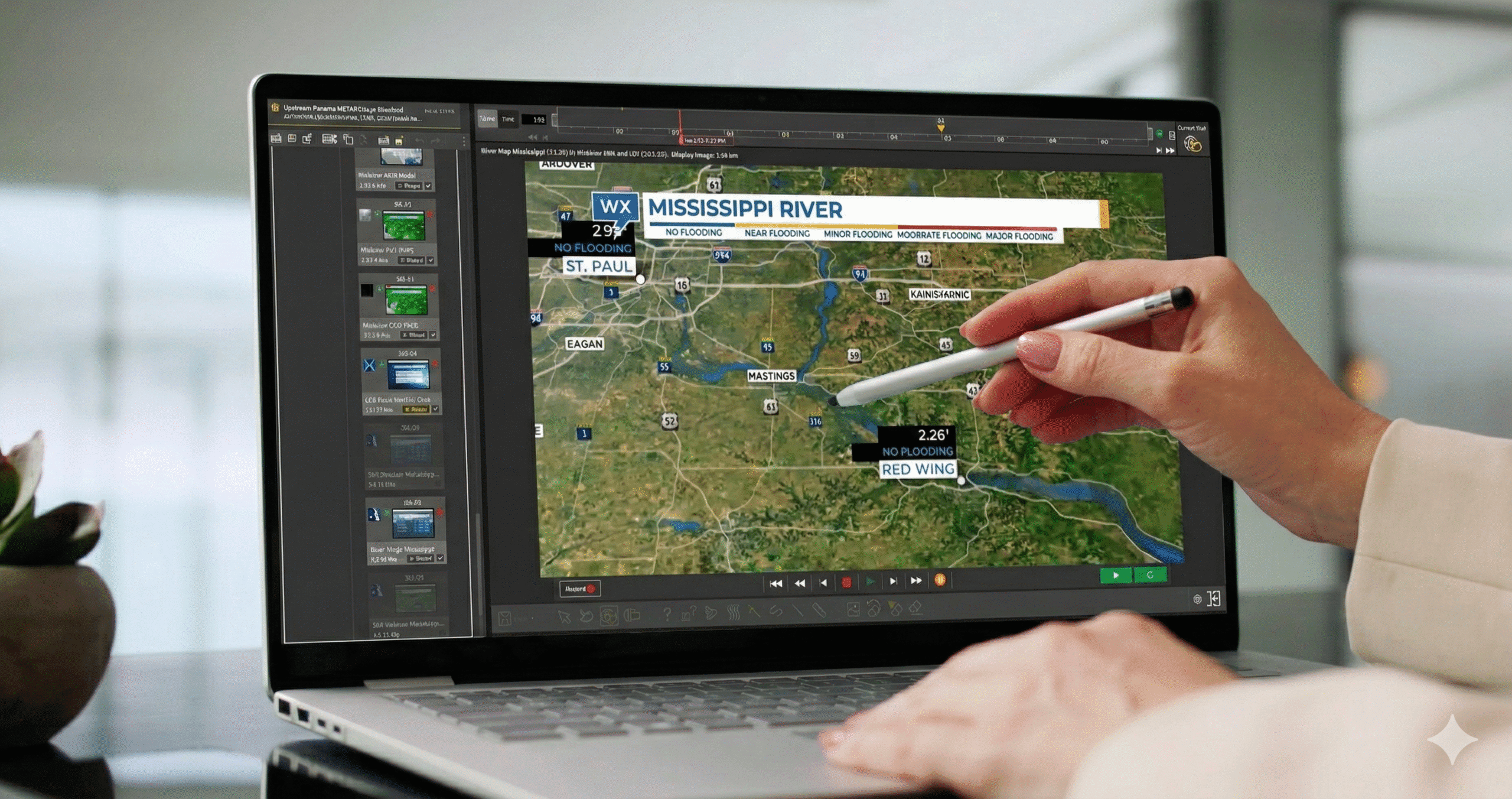
- EEC Weather Radar software (EDGE) from The Weather Company displays the data directly from the radar and has an interface for the meteorologist to control the radar’s elevation, antenna speed, surveillance mode, volumetric mode and more.
- The Max broadcast system displays high-quality representations for broadcast showing the most common radar moments (parameters) such as reflectivity, velocity, spectrum width, correlation coefficient (debris) and hydrometeorological hazards (a type of precipitation).
Why is accurate weather radar data so important?
Weather radar is crucial to providing accurate real time and timely hourly “now cast” weather reports. This technology can be the best tool for meteorologists to accurately forecast the arrival of precipitation. Perhaps more important is the ability to forecast the intensity and severity of the approaching precipitation and highlight whether there’s a high or low probability of danger to life and property.
The radar data can also be ingested into forecast models (like the Global High-Resolution Atmospheric Forecasting (GRAF) model from The Weather Company), which aids in much better initialization of data needed to generate better short-range forecasts, generally within 36 hours.
For news stations or utility companies, radar is the backbone of their forecast strategy. Meteorologists use weather radar to help keep viewers informed so they know how to prepare for severe weather and decide if they should evacuate an area. Utility companies use radar data to know when and how to prepare crews for potential outages.
At The Weather Company, we know that an accurate weather radar means a reliable forecast. That’s why we’ve incorporated efficient weather radar technology into our solutions:
What are the benefits of weather radar?
Having the right weather data can drive significant benefits:
- Predict upcoming storms: With a high-quality weather radar system, your team can detect hazardous weather like tornadoes, hail or flooding as well as locate and calculate the speed of precipitation to support accurate arrival times.
- Reliable and high-quality data: High-quality data can help meteorologists, broadcasters and other industries transform insights into action in a rapid, efficient manner by providing reliable forecasts and accurate results.
- Credibility: Inaccuracies in forecasting can easily disappoint viewers. Delivering more accurate data can earn trust and credibility with viewers to help keep them coming back.
Limitations of a weather radar
While there are many benefits to weather radar, they are not without their limitations. Here are some of the most notable drawbacks:
- Range: The optical range of weather radars is limited to 3 -124 miles. This is due to the curvature of the earth. The radar beam travels in a straight line, meaning beyond its max range, it’s unable to detect objects close to the surface of the ground.
- False readings: Since the radar might be able to pick up precipitation that is higher up in the air, this can give a false reading as a result.
- Droplets can be too small: It can be difficult to pick up drizzle since it often falls below the radar’s beam. The droplets are also sometimes too small to detect.
- Echoes: A weather radar can’t detect any echoes that are close to or above the radar. This is also known as the “cone of silence.”
Integrate a weather radar with your Max solutions
Where can I find more weather radar information and client success stories?
Learn more about our weather radar technology from an industry perspective to understand how it drives results:
- The value of advanced weather radar ownership
- Severe weather: A guide to accurate weather forecasting
Hear from our clients as they break down how weather radar technology and our Max Ecosystem solutions boosted their success:
Learn more about our weather solutions for media companies.
Related resources


Let’s talk
To learn more about our professional weather and traffic software solutions for the media industry, contact our media experts today.
Contact us