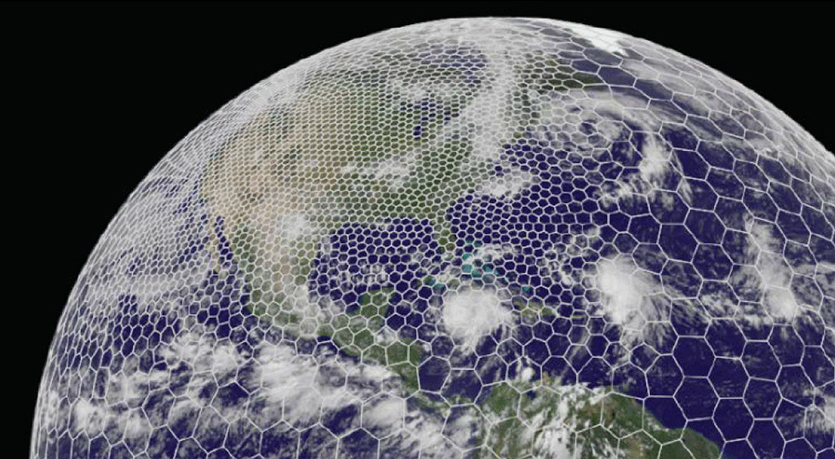
The latest GRAF® weather model improvements
Continue reading

Subscribe
We’re glad you’re here! Subscribe today to receive expert insights, event details, and product news by email.
By signing up, you consent to receiving communications from The Weather Company. You can unsubscribe anytime here or by clicking the unsubscribe link in each email. To learn more about how we handle your data, visit our privacy policy.
Key takeaways
- Modern weather APIs embed predictive intelligence directly into existing flight planning and dispatch screens, removing the need for separate weather monitors.
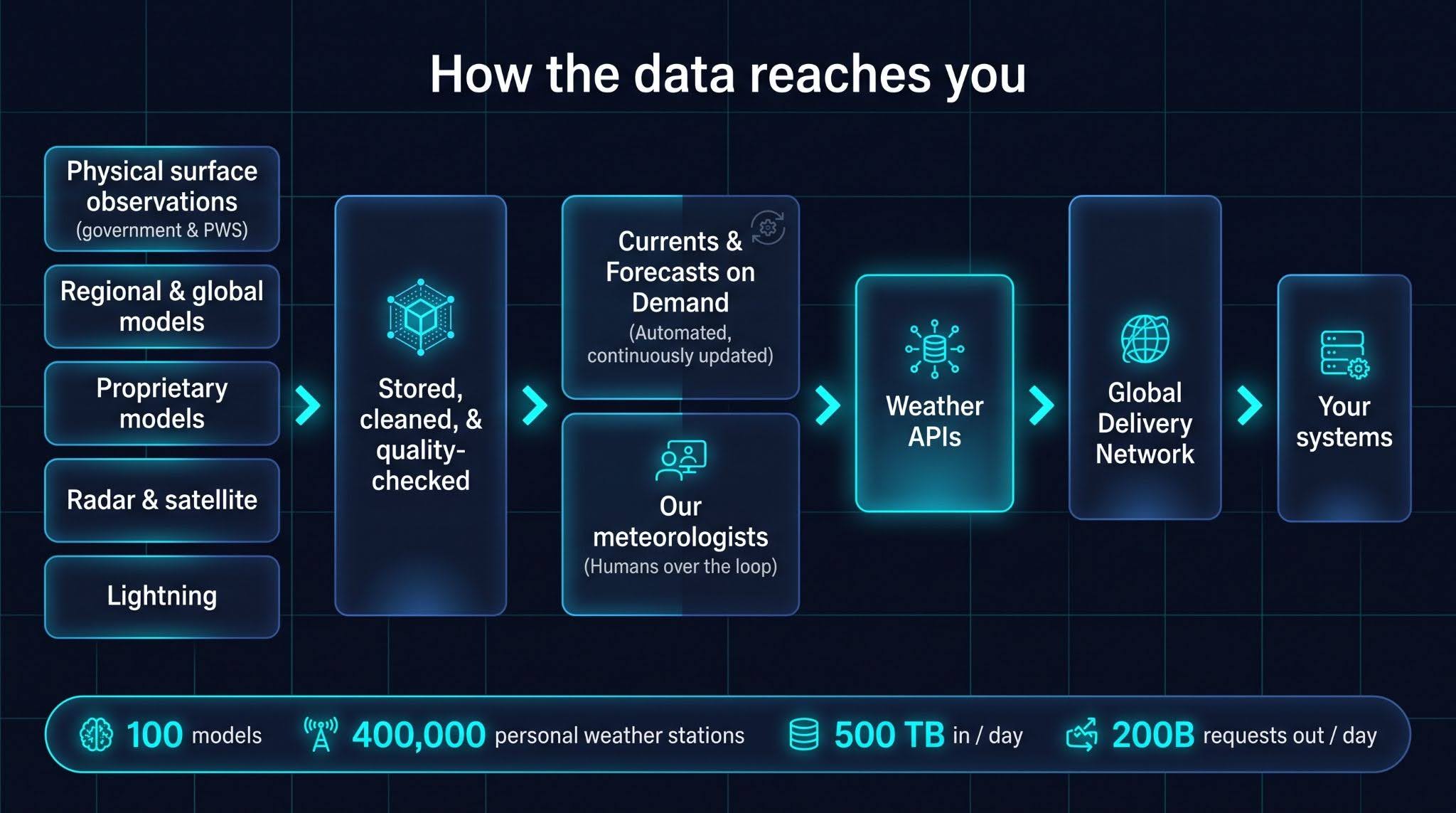
- Powered by 500 TB of daily ingested data, The Weather Company API platform handles 6 trillion monthly API calls with sub-10ms response times (TTFB) maintaining performance during severe global weather events.
- Next-generation multi-point APIs allow airlines to query turbulence (EDR), winds, and convective hazards along an entire flight path across 50 flight levels in a single API call.
The bottleneck in flight management is rarely a lack of meteorological data; it’s how fast and seamlessly that data reaches decision-makers. Real-time, low-latency API integration is moving predictive weather intelligence off standalone monitors and directly into primary flight management systems. With aviation weather APIs, modern airlines are revolutionizing flight dispatch, aircraft load planning, station risk management, and overall operational safety.
What is an aviation weather API?
An aviation weather API is a programmatic interface that ingests raw meteorological data — such as radar, satellite feeds, turbulence models, and surface observations — and delivers real-time weather analytics directly into flight planning, dispatch, and ground operations tools. Instead of requiring dispatchers to check separate weather monitors, APIs embed predictive weather intelligence straight into existing flight management screens.
Architectural backbone: Accuracy, speed, and scale
The Weather Company weather data APIs earn their place in airline operations across three core dimensions: accuracy, speed, and breadth.
| Dimension | Key Performance Benchmark | Operational Impact |
| Scale & Capacity | 6 trillion API calls per month (~200 billion daily) | Maintains platform resilience during severe global weather events. |
| Ingestion Pipeline | 500 terabytes ingested daily from 100+ sources | Synthesizes METARs, 100+ weather models, and 400,000 personal weather stations. |
| API Speed (Latency) | <10 milliseconds Time-to-First-Byte (TTFB) | 7x faster: the time between when an API request is made to the time the first byte, or piece, of the response starts coming back. |
| Data Tail Latency | <200 milliseconds for the slowest 1% of queries | Slashes response lag from 1 second down to sub-200ms across high-volume traffic. |
Key technical features driving flight management innovations
Our next-generation aviation APIs move beyond simple point lookups and static map tiles, delivering high-density, 3D atmospheric data directly into flight planning and dispatch systems.
Multi-point route APIs & 3D flight trajectories
Traditional weather APIs return weather data at a single point (latitude/longitude) or as flat map tiles. Modern multi-point route APIs allow dispatch systems to query weather data along an entire 3D flight path across time, altitude, and trajectory in a single API call.
- Sample routes in a single call: Query time- and altitude-accurate weather across an entire flight path at custom spatial or temporal intervals in a single API request.
- Evaluate 3D turbulence: Analyze turbulence data across 50 flight levels simultaneously with our proprietary GRAF® modeling system to help dispatchers and pilots adjust altitudes around turbulence bands and severe wind shear.
- Extract key atmospheric parameters: Retrieve specific variables—such as wind speed, reflectivity, and echotops—at fixed distance intervals or time steps along the route.
- Support flexible spatial geometries: Process line-string flight paths or multi-point arrays to monitor weather across an entire flight network.
High-efficiency single-site radar
Modern flight operations require granular radar views to navigate convective weather around terminal airspace:
- Ingest full-suite radar feeds: Deliver NEXRAD Level-2 and all sweep-based Level-3 radar products—including reflectivity, velocity, spectrum width, and precipitation type—directly into operational platforms like Maverick® and consumer apps like Storm Radar.
- Expand regional radar coverage: Integrate high-resolution single-site radar capabilities across broader territories, with Canadian radar feeds joining the global portfolio next.
Historical data replay (“Replaying the sky”)
Airlines can archive gridded datasets for 92+ days to re-simulate historical flight routes under past weather conditions.
- Archive gridded datasets automatically: Retain historical weather data for 92 days by default, with extended retention options available for specialized enterprise requirements.
- Support simulation and post-event analysis: Assist safety and flight operations teams with post-flight audits, predictive model testing, flight simulator training against real past conditions, and automated dispatch logic backtesting.
Interactive developer hub
To streamline integration for airline developer teams, The Weather Company’s developer portal provides comprehensive tools:
- Interactive endpoint testing: Developers can test live endpoints — including the Multi-point Route API—and inspect structured JSON responses in real time using a valid API key.
- Package specifications: Tailored API documentation categorized by domain (Examples: Aviation Core, Enhanced Core, Enroute, Severe Weather) helps technical teams identify exact data schemas.
0
different API products publicly offered
+
API endpoints in our portfolio
Transform your operations with weather APIs from The Weather Company
The most useful weather data is the data your team never has to leave their primary tools to find. By embedding high-density, sub-10ms weather data directly into flight planning and dispatch workflows, airlines can eliminate blind spots, automate payload decisions, and improve station-wide predictability.
Next steps for operations & tech teams
Ready to eliminate weather blind spots in your own flight systems?
- Evaluate your screen gaps: Audit where dispatchers or flight crews are currently leaving primary tools to manually lookup weather.
- Test live endpoints: Visit The Weather Company Developer Portal to explore API packages, test multi-point route queries, and evaluate live payload responses.
- Focus on the decision: Contact us with your specific operational challenge — whether it’s high-density payload capping, automated holding alerts, or 3D turbulence avoidance — to configure the ideal API suite for your enterprise.
Get started
Contact our experts today to discover how Weather Data APIs can empower your decision-making and strengthen your business resilience. Let us help you transform weather data into a strategic asset.
Contact usFrequently asked questions
By integrating role-based controls and severity thresholds, APIs deliver tailored weather information to specific teams — preventing dispatchers and flight crews from receiving redundant alerts.
Standard map tiles require client systems to download and parse large image overlays. Multi-point APIs allow flight software to query raw numerical data along a specific flight route and altitude profile in a single, lightweight call.
Yes, gridded weather APIs allow airlines to archive past weather conditions, enabling flight operations to replay severe weather scenarios for pilot training, flight simulation, and post-event analysis.