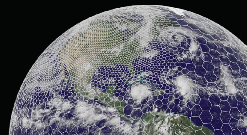
The latest GRAF® weather model improvements
Continue reading

Proximity™ microscale forecasting
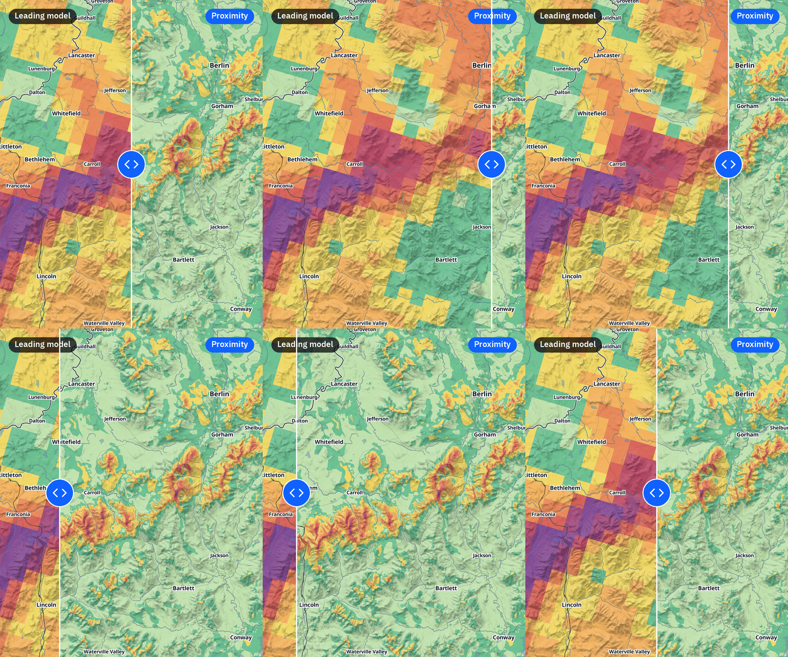
Proximity™ from The Weather Company captures the places that sit side by side and get different weather: the valley floor against the ridge above it, the shoreline against the street behind it, the open golf course against the neighborhood around it.
Weather is local. This is micro. Why most weather forecast models miss hyperlocal conditions.
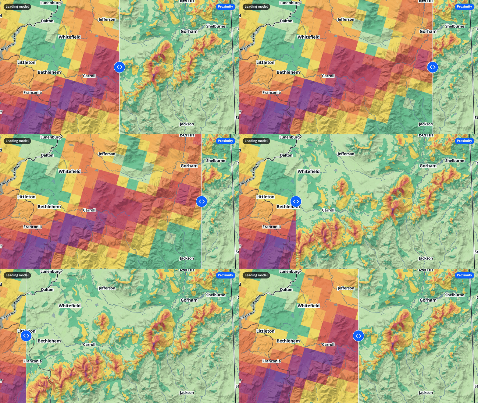
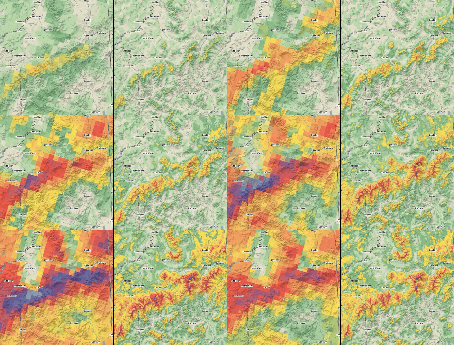
Standard forecasts average weather across entire counties. Proximity™ closes meteorology’s “last mile” by resolving temperature, wind, and precipitation type down to 90 meters—delivering decision-grade precision where land, water, and elevation collide.
Standard regional models average weather across 3-10 km grid boxes. While effective at tracking macro shifts, they wash out the microclimates where two areas just hundreds of feet apart experience drastically different conditions at the same time.
Proximity at a glance
m
Resolution
Detail down to ~300 ft (football field scale) where complex terrain demands it.
hrs
Horizon
Hour-by-hour forecast interval for the next two days.
x
Daily updates
Continuously refreshed via leading models and real-time inputs.
The Weather Company advantage: Backed by the world’s leading weather engine
Proximity is part of an integrated, enterprise-scale forecast ecosystem:
- 400,000+ Global Observation Stations: The world’s largest proprietary surface data network feeding continuous ground truth.
- Professional Meteorologists: Expert human oversight validating mission-critical forecasts.
- Enterprise-Scale Architecture: Cloud-native pipeline handling trillions of monthly API requests with high availability.
- Active Consumer Ecosystem: Validated and experienced in market-leading apps, including Weather Underground (premium 2D map layer) and, coming soon, Peak Ready (base, mid-mountain, and summit resort forecasts).
AI speed meets atmospheric physics rigor
Proximity does not guess. It bridges statistical machine learning with physical atmospheric dynamics and expert meteorological oversight.
Step 1: Dynamical physics baseline
Proximity begins with high-resolution numerical modeling (such as NOAA’s HRRR) 4 times daily to capture upper-air physics and moisture transport.
Step 2: Train on verified ground truth
Statistical AI analyzes years of historical observations across thousands of trusted weather stations—from airport ASOS networks to remote mountain mesonets.
Step 3: Adaptive computing engine
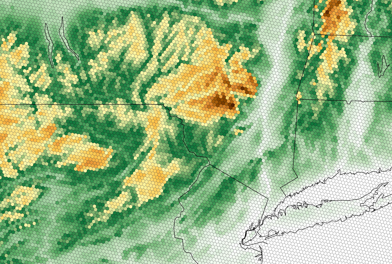
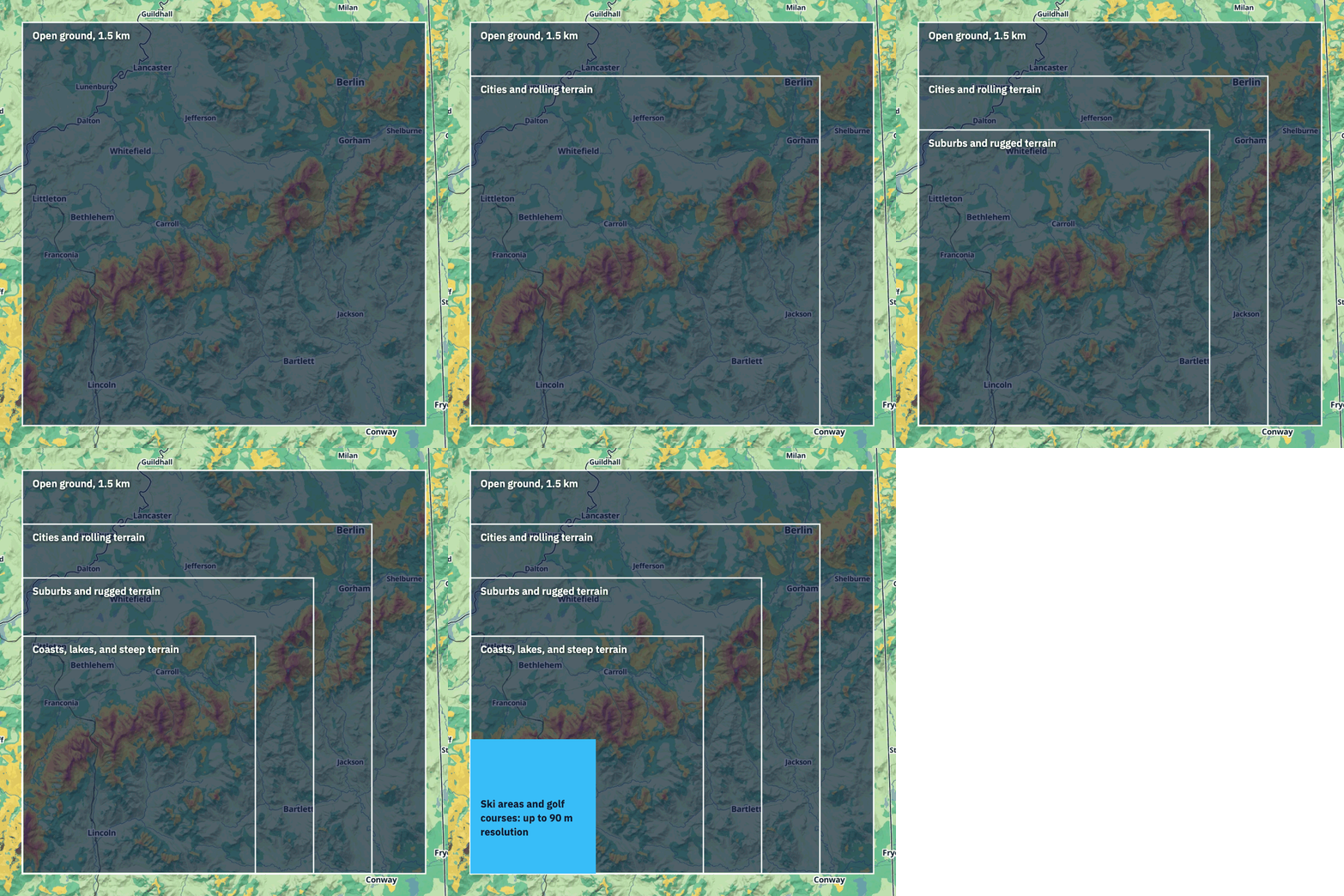
Variable-resolution mapping directs computing power where it matters most. Dialing down to 90 meters over complex terrain and scaling to 1.5 km over flat, uniform ground reduces computational overhead by 25x while retaining maximum localized fidelity.
Step 4: Physical guardrails & expert oversight
Physics-based constraints govern phase changes (rain vs. snow vs. freezing rain), reinforced by expert meteorologists ensuring real-world consistency.
Proximity core capabilities
| Parameter | ProximityTM | Standard model |
|---|---|---|
| Spatial resolution | 90 meters (~300 ft) over complex terrain / 1.5 km over flat plains | 3 km to 13 km uniform |
| Forecast horizon & interval | 48-hour horizon at 1-hour step intervals | 1- to 3-hour intervals |
| Update cadence | 4 cycles daily (synchronized with 00z, 06z, 12z, and 18z dynamical runs) | Hourly to 6-hourly |
| Supported variables (live) | 2 m temperature, 2 m dewpoint, 10 m wind speed & gusts, wind direction, precipitation type | Standard bulk parameters without elevation calibration |
| Roadmap (3-6 months) | Precipitation probability & accumulation | Not included |
| Delivery architecture | Available through The Weather Company’s data APIs (point queries and map tiles) | Bulky GRIB2 files |
Real-world example: Mountain forecasts
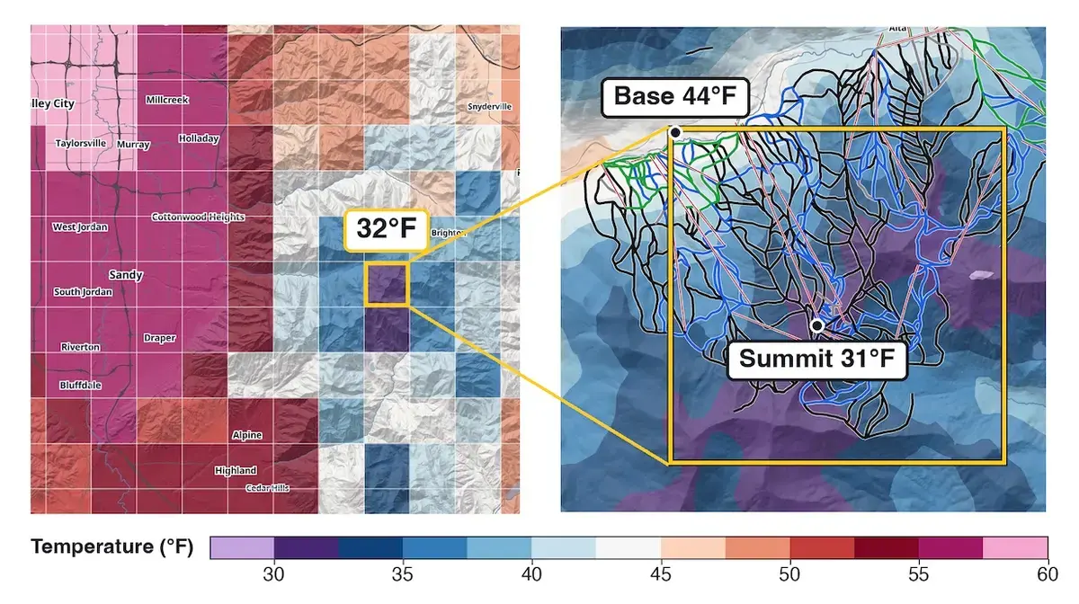
Base, mid-mountain, and summit. Now with even more terrain detail
A mountain doesn’t have just one forecast. The Weather Company’s mountain forecasts (available soon in the Peak Ready app) give the base, mid-mountain, and summit each their own forecast, about 15 days out.
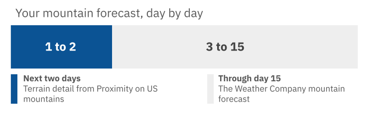
Then, Proximity goes further. On the map, it adds a forecast point roughly every 90 m across the mountain, thousands at a large resort, for the next two days. Your resort forecast at the base, mid-mountain, and summit draws on those points too.
Operational decision intelligence where it matters most

Energy & Utilities
Dynamic Line Rating (DLR): Capture cooling crosswinds along narrow cleared rights-of-way to safely maximize line throughput without triggering outages when overheated transmission lines sag toward vegetation on hot days.
Grid hardening: Pinpoint localized canyon wind jets and targeted line-icing hazards before lines fail.

Agriculture
Cold-air drainage tracking: Pinpoint exact microscale frost pockets on valley floors hours in advance, allowing growers to activate wind machines or heaters only where high-value crops are threatened.
Spraying & field logistics: Monitor microscale wind speeds and dewpoint depressions along individual acreage parcels.

Transportation & Logistics
Phase-change precision: Determine whether mountain passes and transit corridors will see wet asphalt, sleet, or black ice based on micro-elevation thermal profiles.
Port & terminal operations: Accurately forecast wind shear and funneling around headlands, breakwaters, and harbor channels.
Deep dive into the science behind Proximity™
How do statistical neural networks combine with dynamical models to solve meteorology’s last-mile challenge? Read the Q&A with The Weather Company meteorological science experts Trevor Alcott and Joe Koval.
Frequently asked questions
Proximity is The Weather Company’s microscale forecast. It uses a proprietary AI model that learns, from thousands of trusted weather stations, how terrain, land use, and water shape local temperature, dewpoint, and wind. It then applies that across tens of millions of forecast points.
Proximity provides up to 90 m resolution at ski areas and golf courses, where conditions can change quickly over short distances. Over open ground, where weather changes more gradually, it is 1.5 km.
Proximity provides hourly microscale forecasts for the next two days, updated four times a day. Past 48 hours, The Weather Company’s standard forecast takes over.
Proximity currently forecasts temperature, dewpoint, wind, gusts, and precipitation type (rain, snow, or ice). Precipitation chance and amount, including snowfall, is coming soon.
Proximity is currently available in the contiguous U.S. via the Weather Underground premium map and coming soon to Peak Ready mountain forecasts.
Proximity compares years of forecasts with what thousands of surface weather stations actually recorded. From that, it learns how the land and water around each station impact the weather and uses those patterns everywhere on the map, including places between stations.
The Weather Company’s resort forecasts, in the Peak Ready app, cover the base, mid-mountain, and summit about 15 days out. At US resorts, Proximity maps the whole mountain at up to 90 m resolution for the next two days, and the base, mid-mountain, and summit forecasts draw on it.
No. Proximity is one component of The Weather Company’s forecast operation, which brings together observations, global weather models, meteorologists, and delivery to millions of people.