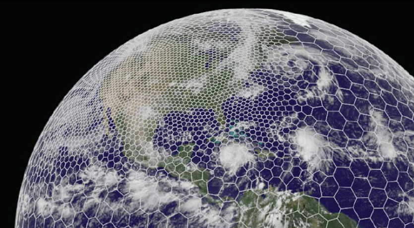
The latest GRAF® weather model improvements
Continue reading

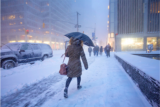
From flurries to blizzards, leverage our winter weather tools to prepare
No matter the industry, blizzards and major snowstorms impact businesses. Whether your business is at the center of the storm, or feels the effects in other ways, it’s essential to stay on top of the latest forecast.
The Weather Company offers products that help businesses across industries understand the blizzard forecast, predict the impacts and make better decisions in the face of Mother Nature. With the right tools and our meteorological expertise, businesses can adapt faster, be more proactive and ride out the storm.
Blizzard FAQs
What is a blizzard?
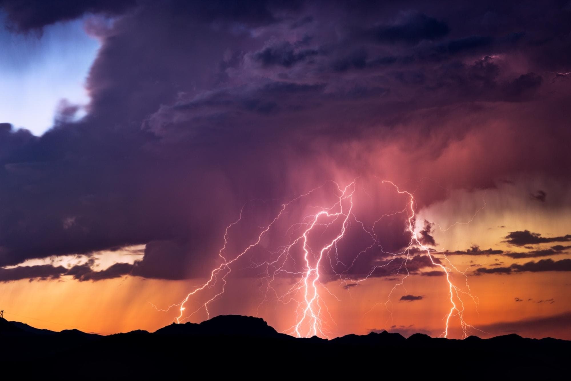
Understanding what separates a blizzard from a typical snowstorm is essential when forecasting one. Blizzards are snowstorms that have heavy snowfall and strong winds, typically in excess of 35 miles per hour. Another huge differentiator between a typical snowstorm and a blizzard is low visibility, which does not extend beyond a quarter-mile.
How are blizzards forecasted or detected?
Satellite images are used for determining cloud patterns as well as movement of winter storms. By looping multiple satellite images together, forecasters can see a storm’s development and potential progression. Radar is also critical for tracking and identifying types of precipitation. Doppler radar, in particular, can show wind direction, which is helpful for forecasting near mountains or large bodies of water.
If radar shows wind that is blowing upslope, forecasters will know automatically that this is the development of precipitation. If the radar shows wind that is blowing over a larger section of a body of water, then they will also know that there is a potential for the formation of precipitation, due to the amount of moisture.
What are whiteout conditions during a blizzard?
A whiteout is when snow-covered areas provide severely reduced visibility, making it almost impossible for drivers to see the road. Whiteouts can occur during blizzards when snow on the ground becomes windblown.
Snowstorm FAQs
What is a snowstorm?
A storm where snow precipitates with minimal winds is called a snowstorm. In the wintertime, most precipitation that forms is snow, due to the temperatures at the top of storms, which are cold enough to make snowflakes. Snowflakes are a collection of frozen ice crystals, which form as water vapor condenses into water droplets, and then freeze. These ice crystals begin to stick together when they fall towards the ground, forming snowflakes.
What is the difference between a blizzard and a snowstorm?
A snowstorm, or winter storm, is generally considered less severe than a blizzard, due to the lack of high winds and low visibility, but they can still be dangerous. Blizzards, on the other hand, have sustained winds, as well as low visibility that last longer than 3 hours. Winter storms are characterized by their near-freezing or below freezing temperatures, as well as a “wintery mix” precipitation, which can include snow, ice, freezing rain and sleet.
Are snowstorms hard to forecast?
In short, yes, snowstorms are relatively difficult to predict. Snow is much more tricky to forecast than rain, in particular, because small details can have major impacts on how snow systems develop. If a weather model gets any minor detail wrong, it can drastically change the actual forecast.
What causes snowstorms?
Snowstorms form just as a rainstorm would: when a mass of warmer, moist air moves over a mass of cold air. When this rising moist air is within an extratropical cyclone, the cyclone forces the warm air mass up and over a cold air mass. If the air near the surface is above freezing point, the snow will fall as rain instead. Alternatively, if this process occurs when the temperature has fallen below freezing (32 degrees Fahrenheit and 0 degrees Celsius), the rain will turn to snow.
Where blizzards and snowstorms are located
Where are the blizzards?
For the most part, blizzards can happen anywhere in the United States. They most typically occur in the Midwest and along the Great Plains. They are most unlikely to happen on the Gulf Coast or the California Coast. As long as the conditions are right, however, even in typically warm climates, a blizzard can take form.
How do blizzards form and affect different areas?
Midwestern United States
The Midwest encounters a variety of severe storms year round, because of frequent passages of different air masses, as well as unstable atmospheric conditions. During the winter, there are snowstorms, ice storms, high winds and even sleet storms – all of which are deadly and damaging to the environment, property and transportation in the Midwest.
According to the Illinois State Water Survey, severe snowstorms occur most often, with about 4 to 8 per year. Ice storms are also frequent, averaging about 4 to 5 days per year in the north. Due to the severity of the winter storms, the midwest averages a loss of $318 million each year. In 2021, a winter storm brought widespread power outages and water disruptions to Texas. It left a heavy toll on the state, being one of the worst storms to land in that region.
In April 2022, North Dakota experienced a historic blizzard, with 1-3 feet of snow. The drift caused by the snowfall exceeded 8 feet in some places since wind gusts were measured at around 60mph.
Northeastern United States and Atlantic Canadian Coastlines
The Northeast typically endures blizzards and severe storms, however they are usually called Nor’easters. A Nor’easter is a severe storm that occurs along the East Coast of North America, where the winds over the coast usually come from the northeast. These storms can occur any time of the year but are most frequent and violent between September and April.
Some well known Nor’easters are the Blizzard of 1888, the storm of March 1962, the New England Blizzard of February 1978, the March 1993 “Superstorm” and the more recent winter storm Izzy that brought 21 inches of snow to parts of North Carolina in early 2022. Past Nor’easters have caused billions of dollars in damage as well as severe economic, transportation and human disruption, and in some cases, disastrous coastal flooding.
Canada & Alaska
Although the British Columbia Coast, as well as Alaska, are renowned for their rainfall, they can also experience extremely heavy snowfalls. One of the worst blizzards in Alaska actually took place in one of the snowiest spots on Earth, the Thompson Pass, just outside of Valdez, Alaska. In 1963, they had a blizzard which dropped six and a half feet of snow onto the Richardson Highway. This was one of the largest snowfalls ever recorded on the planet.
Northern Europe
Due to the location of Northern Europe, near the western margin of the Eurasian continent, they experience large amounts of snowfall. An example of a particularly heavy snowy winter was the winter of 2019/20, when strong westerly flow from the Atlantic Ocean, as well as intense cyclone activity resulted in both unseasonably mild temperatures and very abundant precipitation.
Asia
Due to its proximity to the north, Asia and Eurasia are typically hit with cold snaps, which can result in blizzards, snowstorms and more. One specific example is the East Asian snowstorms of 2009–2010, which were unusually heavy winter storms, and included blizzards, as well as ice storms, and other winter events.
What states in the U.S. get the most blizzards?
North Dakota, South Dakota and western Minnesota lead the nation in the amount of recorded blizzards. Each year, there is a 61% chance of a blizzard in these states. Additionally, Vermont, Maine, New Hampshire, Colorado, Alaska and Michigan have all had many relatively dangerous blizzards over the years.
Are blizzards increasing or decreasing?
A recent study found that the number of blizzards in the U.S. has actually increased by almost a factor of four since the mid-1900s. In the study published in the January 2017 issue of the Journal of Applied Meteorology and Climate, it mentions that from 1959 until 2014, 713 blizzards in the Lower 48 states were documented. Although global temperatures are increasing, National Geographic notes that extreme weather like snowstorms will continue to increase due to climate change.
Areas such as the Red River Valley of the North experienced its highest number of blizzards between 2021-2022. This area averages 2.6 blizzards per season. However, in the 2021-2022 winter season, they had 11 blizzards.
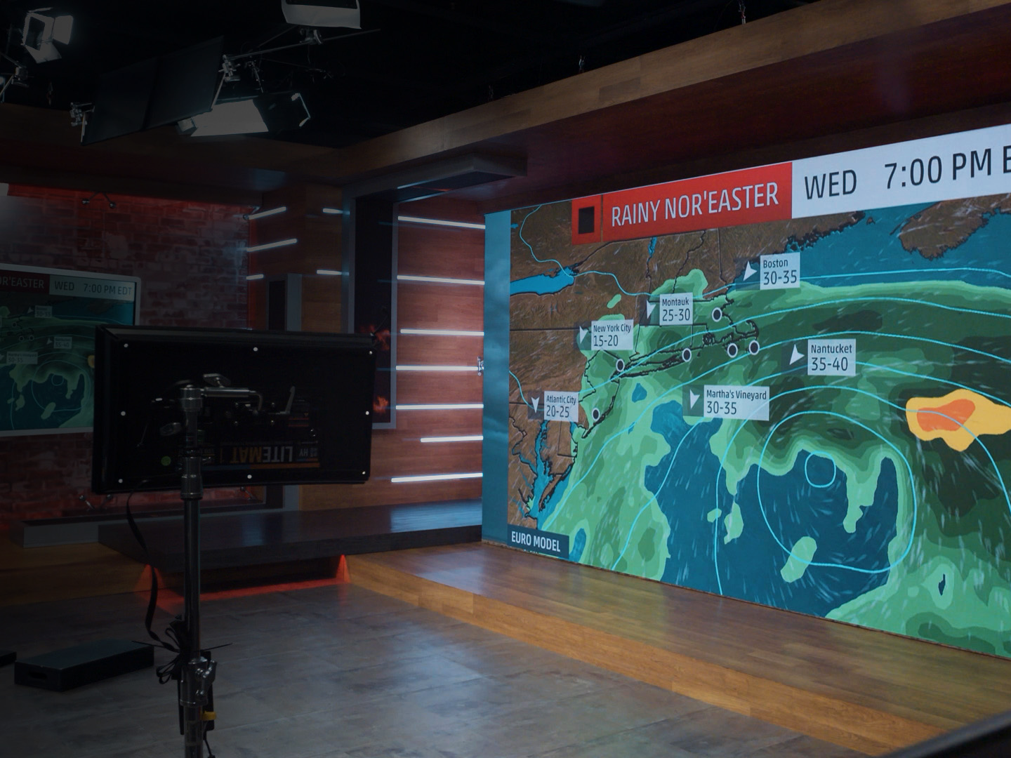
How can broadcasters help communities prepare for a blizzard?
Leverage opportunities. Prepare for the worst. Stay proactive.
A snowstorm can debilitate an entire city or region for an extended period of time. Whether it’s grounded flights at the airport, spikes in grocery sales in advance of a storm or increased viewers on a local broadcast station, blizzards can wreak havoc on businesses. That makes winter weather forecasting technology essential to ensure your business is ready for whatever the storm brings.
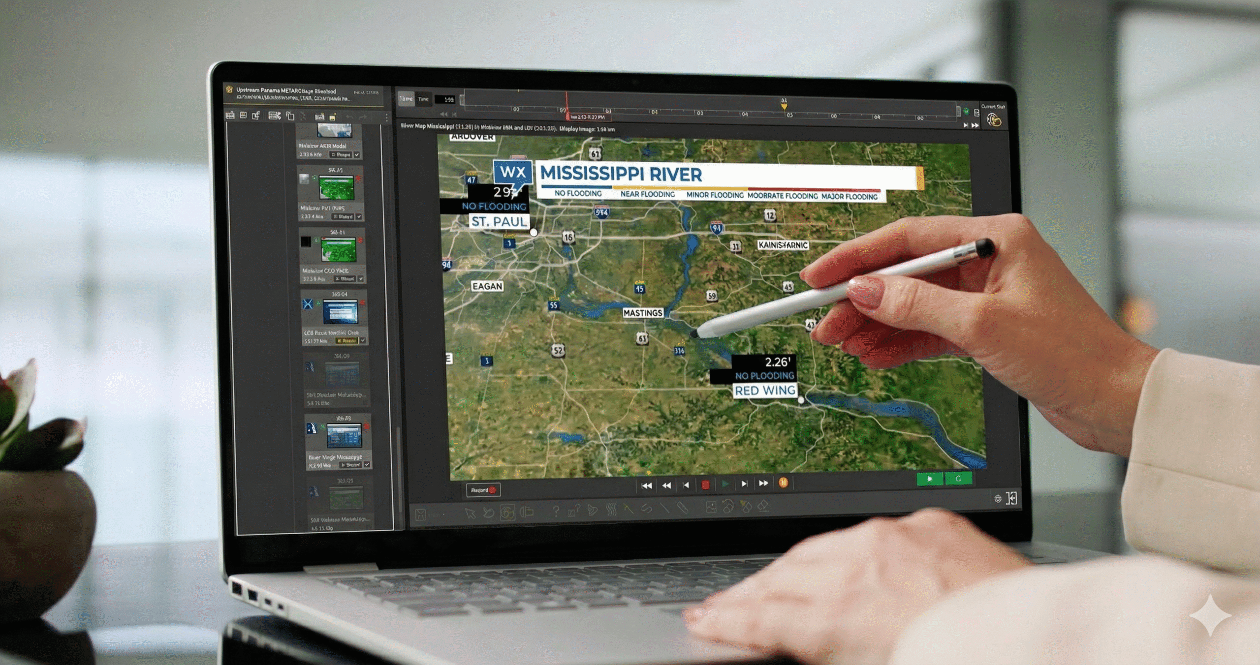
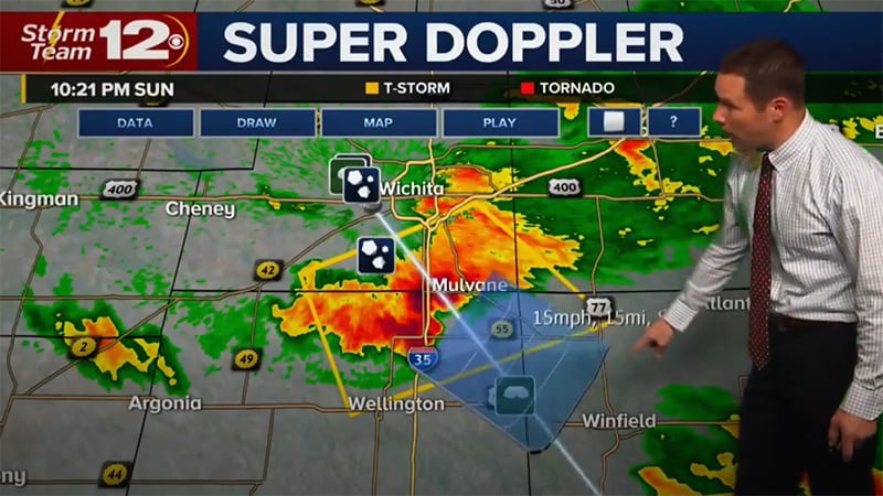
Storms are a time for broadcast stations to shine. It’s critical to keep your audiences informed and engaged across channels all throughout a severe weather event. Our Max Ecosystem, with tools such as Max Storm, helps make the process of covering a blizzard more manageable and effective.
By combining enterprise-class news video production tools, as well as stunning visualizations, with advanced weather data, you can produce emergency blizzard alerts with ease. Creating a seamless and informative experience across platforms can help you publish important information quickly and effectively.
Final thoughts
Heavy snowfall from blizzards can be extremely hard to predict in advance. Tools, such as Max Storm, can help you post any immediate threats, whether that is wet weather moving into an area, or temperatures falling into a range that could produce large amounts of snow. Learn more about how The Weather Company can help you with your blizzard forecasts by contacting us today.
Related Resources

Let's talk
To learn more about our professional weather and traffic software solutions for the media industry, contact our media experts today.
Contact us