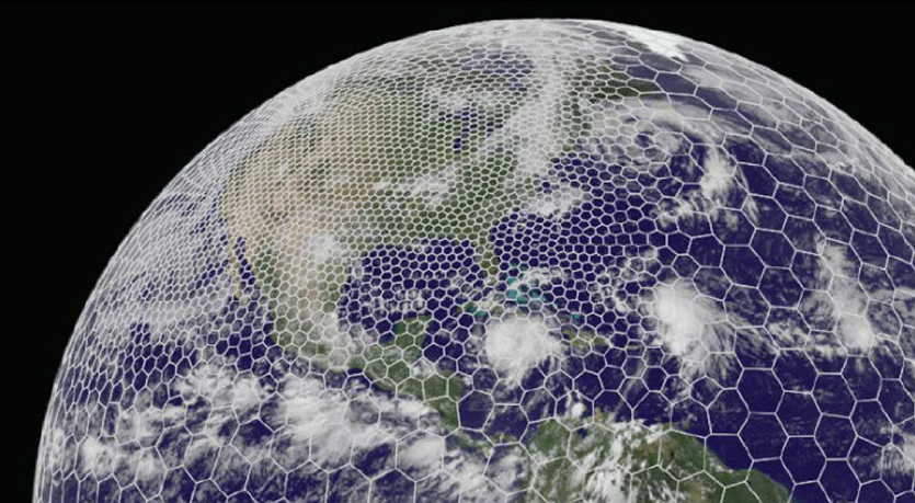
The latest GRAF® weather model improvements
Continue reading

Key takeaways
- Modern weather forecasting runs at hourly and sub-hourly update frequencies across billions of locations globally. Human-Over-The-Loop (HOTL) replaces legacy synchronous human gatekeeping with asynchronous, continuous forecast management.
- Machine learning models handle scale, processing speed, and pattern detection. But they still need expert shepherding to catch model errors, anomalous data spikes, and meteorologically suspect output before it drives downstream decisions.
- Meteorologists draw geographic polygons to assign forecast rules to specific parameters over defined time spans. The system applies those rules automatically whenever data is requested for the relevant location, parameter, and time.
- HOTL was built to add quality control and nuanced forecast adjustments without slowing publication. That matters when weath.
Why expert validation matters in AI weather forecasting
Weather data is easier to access than ever. Open-source models and basic APIs are widely available, which can make forecasts look interchangeable on the surface. They aren’t.
For someone planning a weekend jog, an inaccurate forecast may be a minor inconvenience. For an enterprise making high-velocity operational decisions, forecast quality directly affects cost, risk, and safety. When a forecast feeds a routing engine, commodity trading model, grid operations workflow, or staffing system, a model error at the wrong moment creates immediate exposure.
AI produces forecasts at scale. Experts validate what machines miss.
AI can process atmospheric data faster than any meteorology team. But speed isn’t validation.
Machine learning algorithms identify statistical patterns. They don’t reason through atmospheric physics the way an experienced forecaster does. When model output is mathematically plausible but meteorologically flawed, automated systems can still treat it as fact. It can crunch the raw data, but it lacks the instinct to recognize when those numbers look wrong.
That’s where expert human oversight becomes critical. At The Weather Company, experienced forecasters can spot unrealistic scenarios and make intuitive corrections that AI misses.
The architectural shift: Human-In-The-Loop vs. Human-Over-The-Loop
Understanding the value of modern forecast data starts with how forecasting architectures have changed.
The legacy problem: Human-In-The-Loop (HITL)
Historically, forecast quality control relied on a Human-In-The-Loop model. A computer generated a forecast, a meteorologist manually reviewed and edited it, and then clicked publish. The human was a mandatory synchronous gatekeeper.
As spatial resolution increased and update cadences moved to hourly and sub-hourly cycles, that model became a bottleneck. It’s physically impossible for meteorologists to inspect billions of data points every few minutes. Waiting for manual approval also means data can become stale before users receive it.
The modern solution: Human-Over-The-Loop (HOTL)
Human-Over-The-Loop changes the meteorologist’s role from gatekeeper to forecast manager.
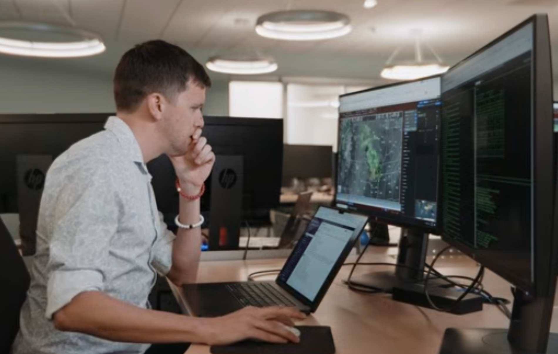
In a HOTL pipeline, automated models can output data continuously to consumer apps and enterprise APIs. At the same time, meteorologists monitor those outputs through cloud-connected workstations and workstation tools that support raster data, point data, bulletin renderings, and point-query analysis.
When a forecaster spots a model misreading local terrain, missing smoke impacts, or over-predicting rainfall, they don’t stop the feed. Instead, they draw geographic polygons over the affected area and configure rules for a specific parameter over a span of time. Those rules are then applied whenever a forecast is requested for the relevant location, parameter, and time.
Analogous example: Think of automated rail control. The train keeps moving. The operator monitors conditions, sets limits, and makes targeted adjustments only when exceptions appear, without stopping the system.
Why AI weather models need human shepherds
As AI weather models improve, do human meteorologists become less necessary? In practice, the opposite often happens. As model velocity increases, expert oversight matters more.
Computer forecasts keep getting better, but they’re still in need of shepherding because of model errors or limits in forecasting certain weather types. AI models can process large historical datasets quickly. But if they ingest noisy radar returns, conflicting sensor data, or terrain-driven distortions, flawed predictions can cascade into downstream systems.
HOTL combines both strengths. AI handles scale, speed, and coverage. Human experts add physical validation, quality control, and accountability.
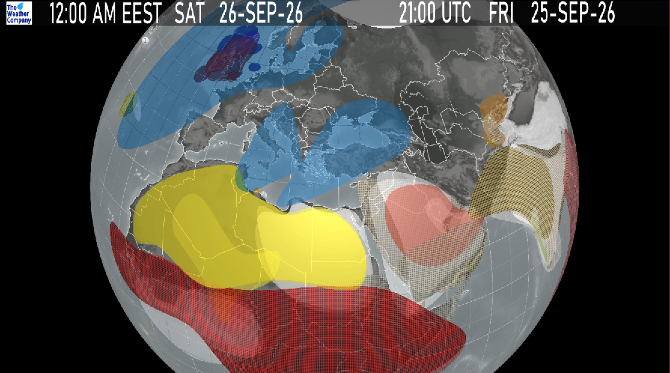
Manually applied filters and rules cover a geographical area over a range of time and gives the data “instructions” on what to change given certain conditions.
How HOTL supports enterprise and consumer workflows
Machine models deliver lightning-fast data, but expert human verification keeps those predictions tied to actual atmospheric conditions. By bridging machine scale with human judgment, the HOTL platform translates complex atmospheric science into practical operational safeguards across both consumer applications and industry-specific workflows:
1. Eliminating “ghost radar” (B2C & public safety)
Radar networks can detect non-precipitating returns, often caused when radar beams bend during atmospheric temperature inversions and reflect off buildings, turbines, or ocean spray. An automated model can misread that clutter as rain and trigger false alerts.
- The HOTL fix: In the RadarPlus instance, meteorologists apply radar echo masks to block non-precipitating echoes from appearing in the radar mosaic. They can also use site-list controls to include or remove data from a radar site in the mosaic.
2. Aviation hazards and collapsing data silos (B2B aviation)
In commercial aviation, dispatch teams and cockpit crews need a shared operational picture. Weather hazard interpretation can’t live in separate tools if flight planning decisions need to move quickly.
- The HOTL fix: In the EnRoute instance, aviation meteorologists author Flight Planning Guidance (FPG) for 3D regions of concern and identify meteorological significance to flights through hazard-specific regions such as turbulence, icing, or volcanic ash areas.
3. Supply chain rerouting and automated webhooks (B2B logistics)
Rerouting a truck fleet because of a false-positive wind or ice signal is expensive. If weather is going to trigger automated actions, the forecast layer has to be governed carefully.
- The HOTL fix: HOTL adds guardrails that keep the automated forecast from doing something obviously wrong. That gives logistics teams a more defensible basis for automating webhook-based rerouting when threshold conditions are met.
4. Grid balancing and commodity hedging (B2B energy)
Energy traders and utility operators depend on temperature and precipitation outlooks to estimate load, generation commitments, and price exposure. Small forecast misses over large load centers can create material financial risk.
- The HOTL fix: In the LongView instance, forecasters publish and adjust seasonal and subseasonal temperature and precipitation anomaly forecasts, including departures from normal.
Under the hood: Asynchronous polygons and developer ergonomics
How does HOTL turn scientific judgment into fast, machine-readable forecast logic?
The asynchronous workflow
- Cloud workstation access: Forecasters log in through password-protected Single Sign-On and connect to HOTL servers in the cloud.
- Visual analysis and point queries: They review weather data underlays such as contours, images, and plots, then use point queries to inspect tabular and graphical forecast details.[1]
- Polygon rule creation: The meteorologist draws a geographic polygon over the target region and sets explicit attributes for the forecast rule.
- Time boxing: Apply rule from 14:00 UTC to 19:00 UTC.
- Parameter tuning: Adjust surface temperature down 3.5°F; cap gusts at 22 knots.
- Audit control: Rules are managed within HOTL instances and organized by office, with user privileges and shared definitions supporting operational control.[1]
- API execution: When a client queries a location inside that polygon for the relevant parameter and time, the rules are applied at request time.
40 years of historical data: The defensibility advantage
In enterprise planning, an AI forecasting platform is only as reliable as the historical data used to train and evaluate its models. Machine learning systems need long, consistent records to backtest performance and isolate weather-driven variables.
The Weather Company brings more than four decades of meteorological history to its forecasting operations, while HOTL adds ongoing human quality control on top of automated forecast generation. That combination gives data science teams a stronger basis for internal model training, risk modeling, and demand analysis.
When insurers price catastrophe risk, utilities commit day-ahead power generation, or retailers automate inventory positioning, they’re not just buying a forecast. They’re depending on a weather input that has to stand up inside financial and operational systems.
Securing enterprise workflows with verified intelligence
The goal of modern meteorology isn’t to remove human expertise. It’s to apply that expertise where it has the highest operational value.
By decoupling human oversight from the automated publication loop, Human-Over-The-Loop forecasting gives developers, data scientists, and business leaders machine-scale forecast delivery with real-time scientific control.
When weather drives decisions, forecast accuracy isn’t abstract. It directly affects operational quality, safety, and margin.
Let's talk
To learn more about harnessing the power of weather to make better, more informed decisions across industries, contact our experts today.
Contact usFrequently asked questions
In a Human-In-The-Loop system, human review is required before data can be published, which slows the process. In a Human-Over-The-Loop system, human input is specified asynchronously from automated forecast generation, so forecasts can continue to publish while experts manage exceptions and add guardrails.
AI models are strong at processing large datasets and detecting complex spatial patterns. But computer forecasts are still in need of shepherding because of model errors and limits in forecasting certain weather types. Human meteorologists add physical verification, contextual judgment, and quality control.
HOTL reduces the risk of costly false positives by adding quality control and nuanced forecast adjustments without blocking the publication process. That matters when forecast triggers are tied directly to routing, staffing, grid balancing, or aviation operations.
HOTL applies human input asynchronously rather than forcing forecasters to review individual requests. That architectural choice removes manual approval from the live publication path. It allows forecast updates to keep flowing while human-authored rules are applied to the relevant forecast request context.
Related resources


Key takeaways
- The forward-deployed model embeds meteorologists directly with enterprise teams, putting them on the front lines of severe weather events.
- Built on The Weather Company’s core infrastructure, an unparalleled data layer that processes up to 2 billion map points every 15 minutes, managing up to 400 billion calls daily.
- Forward Deployed Meteorologists deliver bespoke micro-apps, dashboards, and alerting systems customized for complex company and industry-specific use cases.
- AI skills and templates, paired with Human-Over-The-Loop expertise enables rapid prototyping into production-grade scalability, stability, and support.
As extreme weather events become more frequent and severe, enterprises are looking beyond data and seeking specialized expertise to help them navigate it. In this post, I’m sharing how our team at The Weather Company is shifting the paradigm. By combining our world-class weather science with a ‘forward-deployed’ model, we are integrating — or embedding — meteorological experts directly with our clients to rapidly build and enhance custom, AI-driven tools that solve their most complex operational challenges.
Listen to the full conversation:
Q: The term “forward-deployed” has gained a lot of momentum in AI and software engineering. What are “Forward Deployed Meteorologists”?
A: It’s a new application of something that’s been around for a while. The Weather Company’s meteorological experts have been supporting and advising some of the largest, most weather-impacted brands on the planet for more than 46 years. Traditionally, we would have a meteorologist on-site in the operation center or on call as a partner to work through weather scenarios as they become impactful and as they scale up to severe.
What has changed and why we are aligning to the concept of “forward deployed” is positioning the meteorologists at the front lines of severe events. And that is becoming increasingly important as severe weather events become more common. So our Forward Deployed Meteorologists today are on the front lines, either with the customer in the room, on the phone, or on a video call 24/7 for these severe weather battles that are happening all over the world.
Q: What is the main benefit of embedding management-consulting-level meteorologists?
A: In the past, an enterprise might hire one or two meteorologists to sit on an island within their organization. Our embedded meteorologists are part of a The Weather Company community of over 150 peers pushing the edge of weather science and accuracy. Powering our business and the analytical needs of our Forward Deployed Meteorologists is the world’s best weather science. And we operate on an enormous scale across up to 2 billion points on a map every 15 minutes, serving that data anywhere from 200-400 billion times a day.
Embedded meteorologists, as part of a forward-deployed model, mean that businesses get more than forecasts. They get a bespoke management consultant backed by deterministic and probabilistic data, ensuring highly customized operational awareness.
Q: What foundational technology and AI infrastructure allow the team to spin up bespoke enterprise solutions with speed and scale?
A: In the past, a meteorologist might deliver a custom analysis via a PDF or slide deck. What has emerged is what I would call a “weather foundry.” We have standardized backend data layers and common components on top of it.
Components like mapping, conditional triggers and alerts, workflows, and user access roles and rights are all manifested in what I call commercial off-the-shelf products. These products have a standard set of features and capabilities that are built for tens of thousands, or in the case of our consumer business, hundreds of millions of people.
What has evolved, if you think about it in terms of moving up a maturity curve, is what some technologists would call micro-apps and micro-dashboards created by a Forward Deployed Meteorologist in close collaboration with the “customer of one.”
A single airline, a single utility, or any other enterprise can now have a bespoke manifestation of those capabilities in a UI that is purpose-built for their specific requirements very quickly, utilizing those standardized components and powered by our weather foundry. We also use AI skills and templates to automate and perform quality assurance, provisioning, and testing to move these bespoke micro-apps into production.
Standard off-the-shelf vs. bespoke forward-deployed solutions
| Feature | Off-the-shelf weather SaaS | Forward-deployed Micro-apps |
| Engagement Model | One-to-many product usage | Dedicated “customer of one” collaboration |
| Speed of Tailoring | Standard features, relying on global roadmap updates | Rapid, bespoke UI iteration using AI skills and templates |
| Underlying Technology | Shared core The Weather Company foundry capabilities powering all commercial off-the-shelf SaaS products | Shared core The Weather Company foundry capabilities powering custom micro-apps |
| Dedicated Expertise | Onboarding, support, and self-service documentation | 24/7 dedicated or embedded meteorological management consulting |
Q: How do you rapidly develop applications that transition into fully supported, enterprise-grade software rather than remaining static tools?
A: The weather foundry I mentioned and all the standard componentry have been the foundations of our commercial off-the-shelf products for years. What we can do now is tap into that enterprise-grade infrastructure with custom-built AI templates and skills, using various AI resources to facilitate the rapid prototyping of a user experience that perfectly matches the client’s complex business logic, like predicting snowfall impacts on exact supply routes.
While the front-end interface is entirely unique — maybe they only want alerts when a specific weather condition intersects with a specific polygon on a map representing their asset — it accesses our common data models securely. This gives us an entirely tailored user experience sitting on top of an unshakeable, globally scaled platform.
But data is never enough, and organizations that I’ve spoken to want that Human-Over-The-Loop oversight more than ever. As bespoke experiences are developed and move through quality and production workflows, our expert meteorologists consult, advise, and help direct the features and functions as a deliverable in the bespoke UI.
Q: Can you give us an example of a real-world use case or a practical application for Forward Deployed Meteorologists?
A: While some of our customers have adopted the full life cycle of forward-deployed meteorology, every customer is unique in terms of what level of capability and collaboration that is directly applicable to their business.
Consider an organization that only operates in five cities, and they have a very specific set of conditions that they want to monitor for those five cities:
- What is happening now?
- What is predicted to happen from a deterministic perspective in the next 15 days?
- What is predicted to happen from a probabilistic distribution perspective in the next 15 days?
- What are the longer-term seasonal and sub-seasonal outlooks for those five cities?
That is a very unique set of requirements. Using our AI skills and the foundation of the weather foundry, the meteorologists can prototype, review with the customer, iterate, and move into quality and production workflows to meet those needs. As we continue to collaborate with and support that customer, we can easily continue to iterate as they scale from five to 10 to 20 to 100 cities that they want to monitor.
Q: Where do you see the Forward Deployed Meteorologist program going in the future?
A: One of the most exciting frontiers is the ability to create bespoke data, not just bespoke dashboards. We are developing ways to create custom blends of past, present, and predictive weather conditions, weighted specifically for a client’s unique use case. A Forward Deployed Meteorologist will leverage these custom data blends to build even more accurate micro-apps.
Ultimately, we are committed to continuous innovation. By leaning into responsible AI tooling, we are amplifying our human meteorological expertise. This ensures that no matter how complex the environment gets, we can help businesses across all industries meet their operational goals at scale.
Let's talk
Reach out to learn more about how our Forward Deployed Meteorologists can build custom solutions tailored specifically for your business.
Contact usRelated resources

What’s with the weather dude?
There’s a reason meteorologists are combat trained, jump qualified and embedded into special operations…and HAVE BEEN since World War II. Career Special Operator, let’s call him, “John Doe,” drops in to explain WHY their knowledge is so critical to mission success.
Read about our solutions for Government & Defense to learn how The Weather Company provides actionable environmental insights from the operations center to the tactical edge.
We briefed the team. “Hey, don’t go out of your hide site between this time and that time.” We kind of got the rolling eyes, “Okay, weather dude. Why?”
“That’s because that’s when we calculate dew formation time, based on the humidity and the temperature. And if you’re out and moving around during that time in the morning when the frost develops on the ground, they’ll be able to track you right back to your hide site.”
And that was a big light bulb above their heads moment. You could just see their eyes widen and the response was, “Okay, weather dude, that’s good information.”
I operated in several different environments during the time that I was in the Special Ops weather community. One of the most challenging areas, though, harkens back to our World War II origins in Yugoslavia. And the terrain in Yugoslavia is incredible, and it is actually the reason why, during World War II, we put guys on the ground in Yugoslavia as part of the OSS.
A lot of the missions that were being flown were canceled due to weather. A large number of the sorties had to turn around because they couldn’t find the drop zones. They couldn’t get to the airfields, they couldn’t land. Also of impact in that area, bombing missions were flown out of Italy to bomb the Ploiești oil fields in Romania. Those missions were also impacted by the weather.
So the determination was made that they were going to put guys on the ground in Yugoslavia. They had a lot of volunteers from the 19th Weather Squadron. These guys paved the way for us. They went through the OSS spy training, went through British Jump School. The 19th Weather Squadron, Parachute Detachment—which we have orders on and letterhead—was the first Air Force organized, trained, and equipped parachute unit.
They operated at Tito’s headquarters in Drvar for several months and as a result, the sortie rate increased by 70%. Weather data was coming out of an area that there was previously no data, and it was coming out several times a day. As a result, it significantly impacted both aviation operations for bombing missions and for airlift missions and resupply.
Everything that our guys are doing now has grown from that initial force in World War II on the SOF side and the conventional side. I think that it’s fantastic the resources that the guys of today have. I don’t believe that it’s possible for them to get too much information.
Weather is intel, and it involves doing everything that’s necessary for mission success. A lot of people don’t understand why there would ever be weather personnel—observers, forecasters, officers—that are jump qualified or freefall qualified. In order to support the mission, you need to know the mission. In order to know the mission, you need to be part of the mission. You need to be there.
It’s virtually impossible for somebody who’s sitting in Omaha doing remote support to understand the impact of the mission, having never been there. But if they don’t understand the tactical side and the real true impacts, it’s just not happening.
Let's talk
To learn more about our integrated weather planning, visualization, and execution platform for government and defense, contact our experts today.
Contact usMore videos
27-knot gusts and acceptable risk
Establishing reliable weather forecasting in a location where it doesn’t exist is risky. When that location is BEHIND enemy lines the risk tolerance to get it done skyrockets. Retired Grey Beret, Brady Armistead, joins us to break down the blind HALO drop and why the risk was worth it.
Read about our solutions for Government & Defense to learn how The Weather Company provides actionable environmental insights from the operations center to the tactical edge.
We ramped in, we got out of the airplane, you’re in the dark already. You’re in a dark room, and you open the room into an even darker room. That’s what it’s like jumping off the ramp of the airplane. Get under canopy and realize just from the wind on my face, I’m like, okay, this is not what I was anticipating. This is one of the things that we call blind drops.
My career as a Special Operations weatherman started at Fort Lewis, Washington with 1st Special Forces Group. And while I was there working in the weather station as an observer, I got to watch the 1st Special Forces Group’s Special Operations weather team. And I see them coming to the weather station, getting ready to go on a mission, and I’m sitting on my butt in the weather station, typing stuff on the machines to send it out while they’re going out to do cool stuff. So I was like, you know, those guys look like they’re having a lot more fun than I am. And so that’s what led to my transition to becoming a Special Operations weatherman.
An interesting example of a mission in which weather played a key role in making things happen would be the initial insertion of forces into Afghanistan at the beginning of the war. Our mission was to establish a usable desert landing strip to bring in some other forces, some Marine Corps folks.
When you’re in a foreign country like this, especially Afghanistan and a lot of the states that surround it, they don’t have meteorology. It’s not like you’re in The States that provide weather information into the network and everything else. In Afghanistan, there was nothing. We’ve already done a bunch of analysis, so we talk about the planning process. We already are pretty sure that we can land airplanes there. But just like anything else, got to get eyes on it to ensure it’s accurate.
We were jumping way heavy for the altitudes we’re jumping at. We weighed ourselves in—like I think I weighed in at 700 pounds total to parachute, I think is supposed to hold up to 460 pounds, right? So we’re going—we’re almost doubling what the parachute can hold. But again, we’re going to waive the risk because we need to get these guys on the ground.
That drop, being the crazy weather guy, and I’m like, “Holy crap, the winds are a lot higher than we thought,” because I can feel them. You know, under canopy I can feel the wind. Not just the dropping wind, but the wind coming, you know, horizontally. And I’m like, this is not going to be good.
So the landing was not my best. Like, guys missing kneecaps, freaking broke their ribs. You know, one guy burned off part of his face because he landed face first and got drug by his parachute. The model said the weather is good for static line drop. The weather wasn’t good for static line drop.
When I took my first reading, after everything else, I had a 20—I think it was a 27 knot wind gust happening on the ground at that location, right? So instantly that’s the first thing I’m telling my air traffic control guys, “Hey, winds are 27 knots from this direction,” you know, or you know, whatever it was like 15 gusting 27, you know, right down the LZ, which is perfect for the airplanes, but not so much for the parachutists that usually don’t go much above 13 knots, right, for a static line infiltration.
So, yeah, that’s why everybody was hurt. But so we get up, we’re trying to figure out what we’re going to do. We’ve got to establish the LZ. Like it doesn’t matter that we’re injured. Unless you’re not able to walk or you’re not able to move, you’re getting this thing set up. You’re still mission focused. You’re not going to be sitting there crying and calling for medic or something like that. You can get up and move and do your job. So begin setting up the LZ, assessing it for landing capabilities and everything else, and bring in the aircraft.
When we go back and we talk about all that, it goes back to the meteorological side of this, which was, we did a blind drop and there was no collaborating information. So we’re using model data to make a decision about what the weather conditions were. We went in with what were basically false pretenses of what the weather conditions were going to be like on the ground.
Weather plays a role in everything that we do. When I was a young guy, we called it the “WET trilogy”. So it’s the weather, enemy, and terrain, right? Those three things are constants. No matter what you do, those are three things that are either going to work against you or for you.
But at the end of the day, one of the things that we see is, is that any time that you place weather as a secondary thought process, it bites us in the butt. It doesn’t matter where in the planning process you are. This needs to be included because it’s part of that WET trilogy. If you’re talking about the enemy and you’re talking about the terrain, you’re probably talking about the meteorology, the weather, because that’s part of the entire package.
Let's talk
To learn more about our integrated weather planning, visualization, and execution platform for government and defense, contact our experts today.
Contact usMore videos
Can’t see you. Can’t shoot you.
Here I am in the mountains, climbing up. The rain just comes down. All of a sudden we can’t see. The radar can’t see. There’s a lot of turbulence. I’m having trouble just staying on the controls. I’ve got spatial disorientation. So you feel like you’re tipping end-over-end and side-to-side all at the same time. We are exchanging the controls back and forth about every 30 seconds because that’s all we can tolerate. You’ve got to trust the instruments. You’ve got to trust what you’re doing. Otherwise, you know, I wouldn’t be sitting here talking about it.
You know, in aviation, military aviation in particular, we have what’s called a probable kill ratio. So, for example, a Stinger missile may have a 99% probable kill on a Chinook helicopter with no countermeasures, no tactics. Terrain and weather, we say that the ground has a PK of 100%. Rain that you can’t see through, fog, snow, you know, can really be a challenge, you know, and these are all things that the weather can really affect.
And a lot of times planning is the key. Like understanding where the weather phenomena are, how they affect your particular aircraft or mission. You know, because the aircraft might be able to get somewhere based on the equipment that’s inside. But once you get there, can you do the mission?
I refer constantly back to the early 2001 timeframe right after 9/11, and our responsibility is to fly Special Forces teams or ODAs—ODA 595, later known as the Horse Soldiers, into Afghanistan, to link them up with what we call the Northern Alliance. And then they would, you know, help them to fight the Taliban. And once the Taliban is diminished, we can get to Osama Bin Laden.
And we originally were supposed to have two aircraft to take the 12-man team into Afghanistan, and one of the aircraft was drawn off on a separate mission, leaving me with one Chinook and the entire team. So we stripped the aircraft of armor to save weight. We had to do air refueling on the way in and the way out, which we normally did not like to do.
And almost immediately we cannot see out the window. And the weather forecast was supposed to be decent and I should be able to see 10–20 miles. And I can’t see the tip of the refueling probe, which is only about 19 feet long. So I’ve got the battalion commander, colonel, in my jump seat. He’s sitting, you know, about half a foot behind me and his knees are up against my thigh and he’s like, “Al, what do you want to do?” And I said, “Oh, sir, we just,” I said, “We TF.” So TF is Terrain Following radar. And the colonel said, “Yes, do it.” What I didn’t know was the Secretary of Defense had called earlier and told them to get in no matter what.
And we’re flying along. You can’t see outside. We’re approaching the mountains now, and we make our first turn into the mountains. And we had not planned on using the radar for this. And the radar sees about 10–20 miles ahead. And if you’re going to turn into the terrain, it’s going to see a mountain you plan on not going over. And it gives you what’s called a full climb command. I’m not expecting this climb command. So now I’m trying to figure out what’s going on.
And then the radar reboots on its own, and then it just goes, pfft. If you look straight up through the what we call the eyebrow light window, you can see stars, but below us to our front and just above where we need to see, can’t see anything. So I’m, you know, pulling circuit breakers and resetting things. And we get it back and I start cycling through the map displays to see what are we commanding off of. And I see, oh, there’s a, you know, 12–13,000 foot mountain in front of us. So we just turned the aircraft slightly to the right. The radar lets us down, we go around it and off we go.
Now I still got to get to the target. We come over the final ridgeline, we’re still in the clouds on the radar, and we can’t go past the landing area because there’s an anti-aircraft gun on the other side of a little nub, a little hill. If he sees me, he’s going to turn us into Swiss cheese.
You know, I talk about sometimes using the weather to your advantage. They can hear you, they know you’re there. That’s fine. But if they can’t see you, they can’t shoot you. And we’re expecting what’s called a brownout landing, a loss of visual reference. So we know that when we come in and we pull power to cushion to stop the descent, the rotor wash is going to roil up this cloud of dust.
So my copilot is doing that. Except I can feel that we’re drifting backwards, right. This is me feeling it. And I look at the hover symbology and we are indeed going backwards. And we’re only about 10 feet off the ground. And about that time I feel the aft gear touch the ground as we’re backing up. And I pushed down on the power, so the forward gear comes down and land, we stop, the dust kind of settles, and we’re surrounded by Afghan forces, right. And at the time, you didn’t know these Taliban, are they Northern Alliance, you can only go with what you were told. And these are supposed to be friendlies.
And as the dust went down, we lowered the ramp. Ground Force gets out, the SF team, they meet up with the leader and he looks back, gives me a thumbs up. I’m like, all right, they’re good. So we take off and we retrace our steps doing the same thing.
And then we did that. Unlike in the movie, we did it night, after night, after night, with new teams, and each time we learned a little lesson about the terrain and weather that really over the next 10–15 years, those initial missions and the weather we encountered set the tone for the fight.
Let's talk
To learn more about our integrated weather planning, visualization, and execution platform for government and defense, contact our experts today.
Contact usMore videos
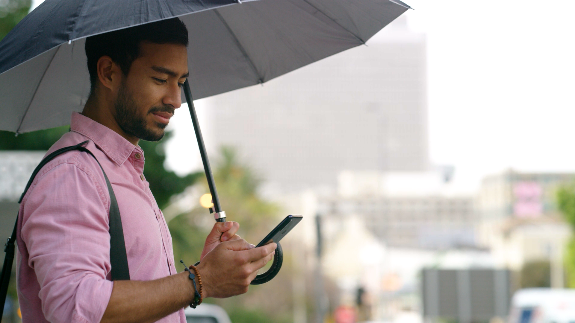
What do we mean by “minutely” forecasting, and how do we do it?
Traditional weather forecasting is great at predicting large-scale shifts days in advance, but answering “Will it rain here in the next ten minutes?” requires a different model. In this short video, learn how we combine real-time radar advection (“nowcasting”) with atmospheric physics to deliver pinpoint, minute-by-minute precipitation tracking and how advanced filtering keeps alerts accurate so you can make confident decisions on the go.
Read the Q&A blog for a deeper dive into the science behind up-to-the-minute precipitation forecasting.
Weather prediction usually works by running physics models on supercomputers that look at very broad regions of the planet, and they’re remarkably good at the big picture. They’ll tell us days ahead that a cold front is moving across the state.
But those models think in big units: grids miles wide and time in hours. So answering the question that people ask most, “Is it going to rain right here in the next ten minutes?” takes a completely different approach.
For minute-by-minute forecasting, we set the big simulation models aside and focus on what meteorologists call radar advection or “nowcasting.” We also refer to it as “minutely” forecasting.
We use the current radar to locate the precipitation, calculate the speed and direction it’s moving, and mathematically determine where and how heavy it will be at any given location in real time. Because it’s built on what’s actually happening right now, it’s extremely accurate in the short term.
But watching only gets you so far, and radar advection accuracy begins to sharply diminish beyond 60 minutes. For example, a single radar scan can’t see a storm that hasn’t formed yet or a cell that’s about to collapse.
So right around the one-hour mark, our system makes a handoff — like one runner passing the baton to the next. The live radar tracking blends into our high-resolution global model, GRAFⓇ, which brings atmospheric physics into play. Merging real-time observation with physics lets us carry an accurate, minute-by-minute forecast all the way out to the 90-minute mark.
Minute-by-minute forecasting isn’t about putting more data on a screen. It’s knowing when to track a storm by watching it, when to bring in the physics models, and how to filter out the noise so what you see is something you can actually plan around.
Before we put a rain alert on your screen, our system cross-checks the radar against several meteorological conditions. If those conditions are not met, we suppress the precipitation alerts.
Reach out to learn more about “minutely” forecasting, precipitation alerts, and the science behind all of our efforts to bring you the most accurate weather data possible.
Let's talk
Reach out to learn more about how we are building uder confidence with accurate, minute-by-minute forecasts.
Contact Us